‘Quinta’ may intensify faster, possible severe tropical storm status before landfall
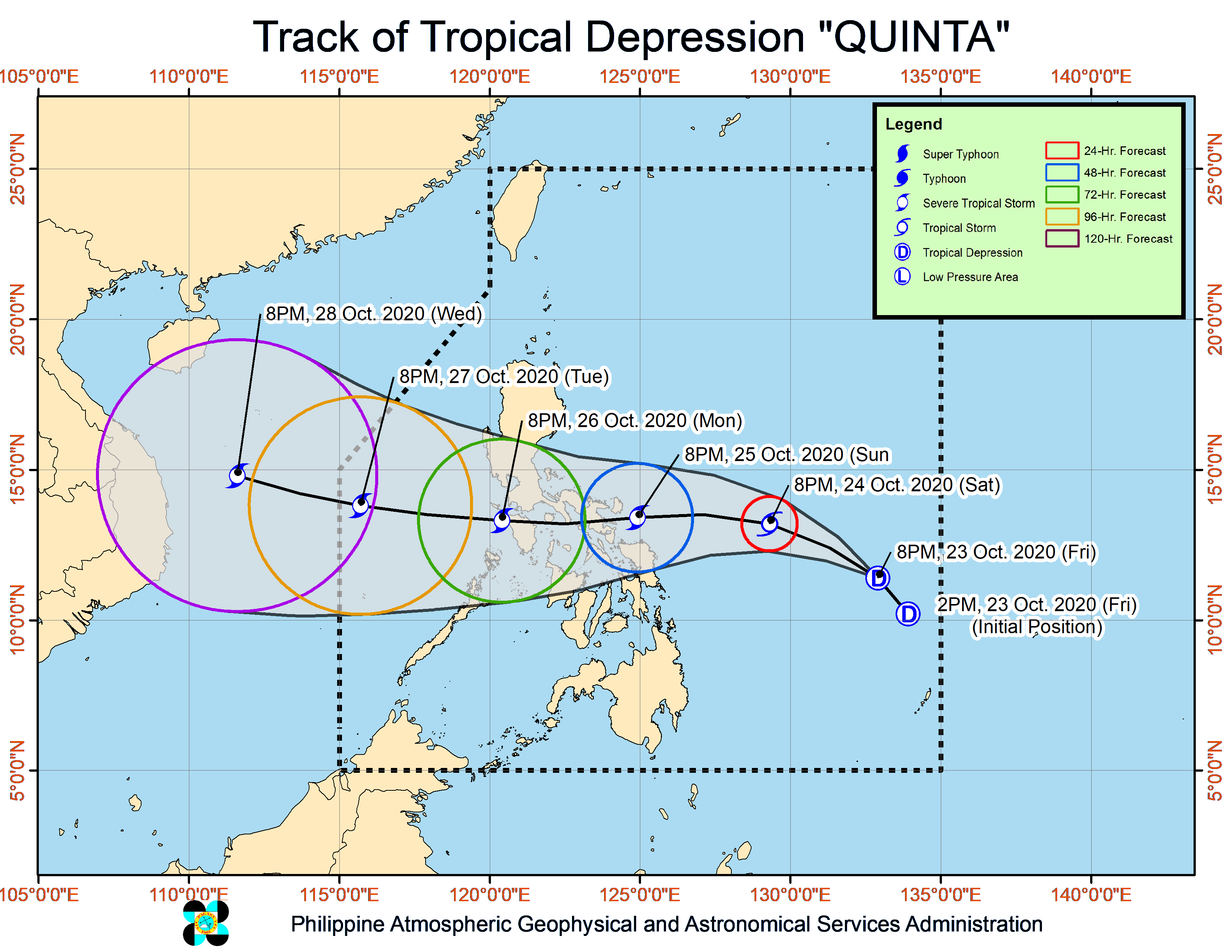
MANILA, Philippines — Tropical Depression “Quinta” is seen to intensify faster than it was initially expected, as state meteorologists now expect it to progress as a severe tropical storm before it makes landfall over Bicol Region.
Late Friday night updates from the Philippine Atmospheric, Geophysical and Astronomical Services Administration (Pagasa) said that Quinta as of now packs maximum sustained winds of 45 kilometers per hour (km/h) and gustiness of up to 55 km/h.
It was last seen 775 kilometers east of Guiuan, Eastern Samar, and is moving northwest at a speed of 25 km/h.
By Saturday night, as it hovers 605 kilometers east of Legazpi City in Albay, it may reach tropical storm category. And when it moves to 130 kilometers east northeast of Legazpi, it may be already a severe tropical storm.
Quinta is expected to cross the Mindoro area through Southern Luzon waters by Monday night, which means areas in Calabarzon and Metro Manila may also feel the effects of the weather disturbance.
It may exit the Philippine area of responsibility (PAR) by Tuesday night or Wednesday morning.
As of now, Quinta still has no direct effect on local weather, but rains would start to pour by Sunday as it nears the Bicol Region landmass. Also, no tropical cyclone warning signals has been raised as of now.
But the troughs of both Quinta and Typhoon “Saudel” (formerly Pepito) will bring light to moderate with at times heavy rains over large portions of Mimaropa, Bicol Region, Visayas, and Mindanao.
A stationary front currently extending over the extreme northern Luzon, due to northeasterly surface windflow surge will also bring moderate to heavy rains over Batanes, northern Cagayan and Babuyan Islands, and the northern portions of Apayao and Ilocos Norte.
Meanwhile, a gale warning is raised over the entire northern and western seaboards of Luzon — from the Ilocos Region down to Zambales, Bataan, western portions of Calabarzon and Mimaropa — plus the waters east of Cagayan and Isabela.
Small boats are not allowed to travel in these areas as waves may reach heights of 2.5 meters to 6.0 meters.