
MANILA, Philippines — Typhoon Pepito may have gone out of the Philippine area of responsibility (PAR) but the low-pressure area (LPA) approaching Mindanao might turn into another weather disturbance.
Weather forecasts on Thursday afternoon by the Philippine Atmospheric, Geophysical, and Astronomical Services Administration (Pagasa) showed that the LPA spotted 1,180 kilometers east of Mindanao – still outside PAR – may gather strength while it hovers above the Pacific Ocean. The LPA is predicted to enter the country’s jurisdiction in the next two to three days.
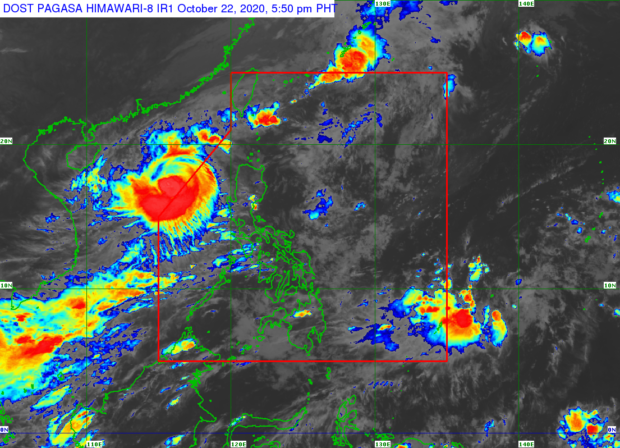
Pepito, on the other hand, was earlier elevated to a typhoon category and was last seen 470 kilometers west of Sinait, Ilocos Sur.
Due to these weather systems, some areas in Luzon may still experience cloudy skies and occasional rains, especially on the western side like Zambales, Bataan, Mindoro, and Palawan, according to Pagasa. Areas in the extreme northern Luzon will have similar conditions but it will be due to the northeasterly surface wind flow, it added.
For the rest of Luzon, Pagasa said, weather will be generally better on Friday as the climate in Metro Manila and Laoag will range from 25°C to 33°C while it may peak to 32°C in Tuguegarao and Legazpi.
In Visayas and Mindanao, Cebu and Tacloban will feel temperatures at 26°C to 32°C while Zamboanga and Davao will experience it by as high as 33°C and 34°C, respectively, the state weather bureau noted.
A gale warning is still up over the whole northern and western seaboards of Luzon, from Batanes to the Ilocos Region, western parts of Central and Southern Luzon, Palawan, as well as seaboards of Isabela and Aurora.
This means that fisherfolk and boat transfer operators using small seacraft are not allowed to set sail in the meantime.