Except in Pangasinan, Pagasa lifts Signal No. 1, 2 as ‘Pepito’ slightly intensifies
MANILA, Philippines — Tropical Cyclone Wind Signal (TCWS) No. 2 was lifted in areas affected by Tropical Storm “Pepito,” as the weather disturbance moved westward over the West Philippine Sea (WPS) on Wednesday.
Only the western portion of Pangasinan (Bolinao, Anda, Bani, Agno, Alaminos City, Mabini, Burgos, Dasol, Sual, Labrador, Infanta) remains under Signal No 1., according to the 11 a.m. bulletin of Pagasa.
Areas under Signal No. 1 are expected to have winds of 30 to 60 kilometers per hour speed for at least 36 hours.
Intermittent rains are likewise to be expected within 36 hours, Pagasa said.
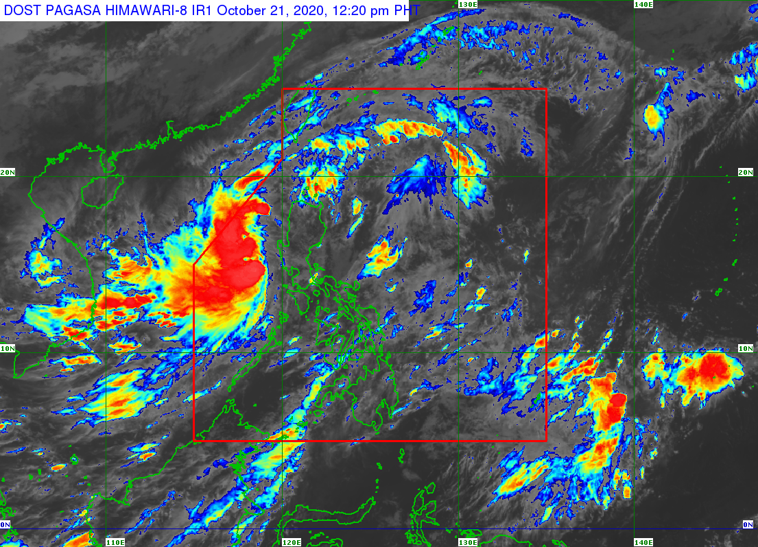
At 10 a.m., Pepito was located 210 km west of Dagupan City, Pangasinan with maximum sustained winds of 85 kph and gustiness of up to 105 kph.
It is moving westward at 30 km/h.
Pepito is forecast to move generally westward or west-northward over the WPS before slowing down and turning northwestward on Thursday.
It is expected to exit the Philippine Area of Responsibility (PAR) on Thursday morning or afternoon, Pagasa said.
Light to moderate with at times heavy rains will prevail over Batanes, Babuyan Islands, Zambales, Bataan, Occidental Mindoro, and Palawan.
The weather bureau also warns of possible flooding, including flash floods, and rain-induced landslides during heavy or prolonged rainfall.
Strong to near gale-force winds will also be experienced in areas under Signal No. 1.
Pagasa said high to gale-force winds due to the northeasterly surface wind flow will also be experienced over the rest of northern Luzon, especially in coastal and mountainous areas
Meanwhile, rough to very rough seas will be experienced in areas affected by the TCWS and Gale Warning.
Such conditions are expected over the entire seaboards of Northern and Central Luzon, the seaboard of northern Quezon including the Pollilo Islands, and the western seaboards of Batangas, Occidental Mindoro (including Lubang Islands), and Palawan (including Calamian and Kalayaan Islands).
“Sea travel is risky over these areas, especially for those using small seacraft,” Pagasa said.
The eastern seaboards of southern Quezon, Bicol Region, Eastern Visayas, Caraga, and Davao Region, meanwhile, will have moderate to rough seas.
Pagasa advised those with small seacraft to take precautionary measures when going out to sea. It likewise warned inexperienced mariners not to navigate in the said conditions.
Aside from Pepito, the state weather bureau is also monitoring a tropical depression outside the Philippine Area of Responsibility (PAR) located at 1,900 km east northeast of extreme northern Luzon.
The weather disturbance is unlikely to enter the PAR, Pagasa said.