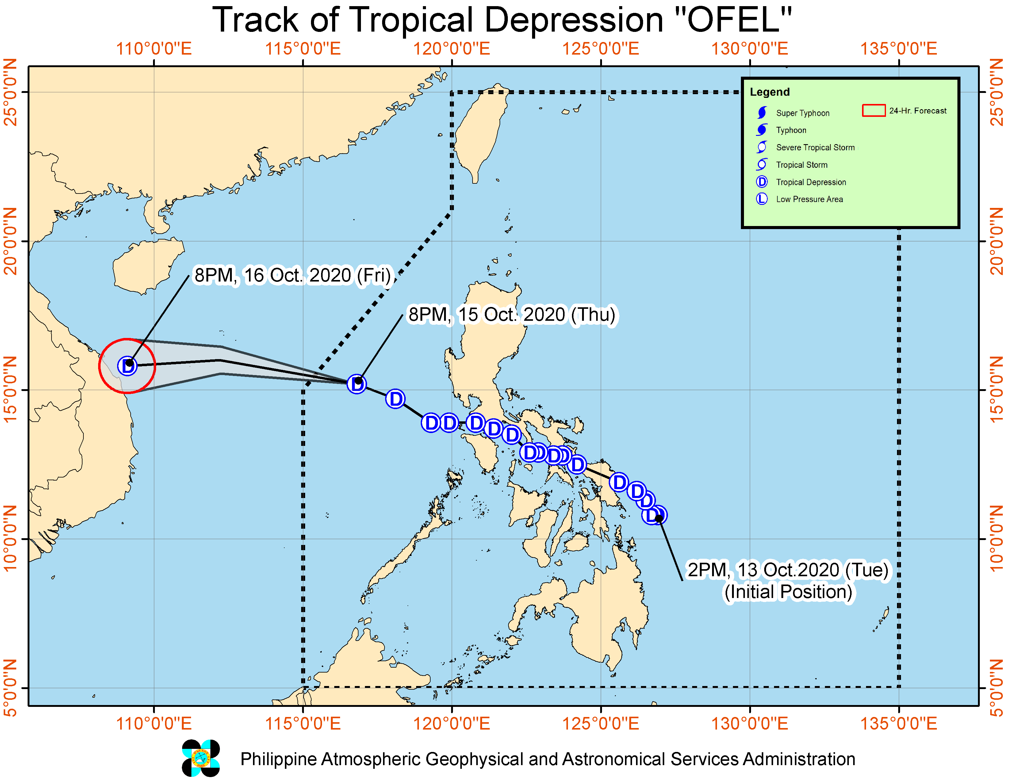

MANILA, Philippines — Tropical Depression “Ofel” has moved closer to the western boundary of the Philippine area of responsibility (PAR), and may eventually leave the county’s area by Friday morning.
The latest severe weather bulletin from the Philippine Atmospheric, Geophysical and Astronomical Services Administration (Pagasa) on Thursday night said that Ofel was last seen 400 kilometers east of Subic Bay, packing maximum sustained winds of 45 kilometers per hour (kph) and gustiness of up to 55 kph.
It is still moving in a west northwestward pattern, at a speed of 25 kph.
As of now, all tropical cyclone warning signals have been dropped, although light to moderate rains may still persist over Mimaropa, Western Visayas, Central Visayas, Northern Mindanao, Bangsamoro, and Zamboanga Peninsula, due to the southwest monsoon or habagat.
Still, Pagasa warned that flash floods and rain-induced landslides may still occur in areas affected by heavy or prolonged rainfall.
A gale warning is still raised over the entire seaboard of Northern Luzon, including Ilocos Region and Cagayan Valley due to the northeasterly surface windflow. This means seafarers and fisherfolk using small boats are still advised against setting sail due to very rough sea conditions.
Meanwhile, the combined effects of the southwest monsoon and the northeasterly surface windflow will also be experienced over the eastern and western seaboards of Central and Southern Luzon.
Ofel is expected to move westward over the West Philippine Sea on Friday, and make landfall over Vietnam by night. However, it is still expected to eventually weaken by the time it makes landfall.