
Source: Pagasa / DOST
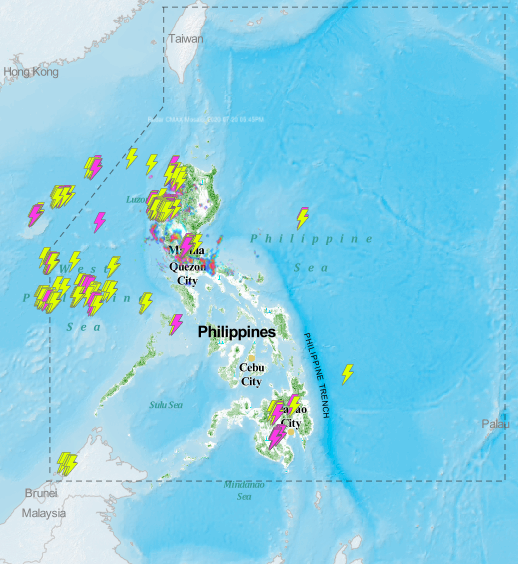
MANILA, Philippines — A low-pressure area (LPA) seen in the eastern part of Guiuan, Eastern Samar is not expected to develop into a tropical depression more so a storm, but will still bring rains over a large part of the country by Monday night and the next hours.
The latest forecast from the Philippine Atmospheric, Geophysical and Astronomical Services Administration (Pagasa) showed that the LPA, last spotted 480 kilometers east of Guiuan, may dissipate within the next 24 hours.
However, the LPA and the intertropical convergence zone will result in rain showers especially in Visayas, Northern Mindanao, Bicol region, and Mimaropa. Meanwhile Metro Manila and the rest of Luzon will experience occasional rains due to localized thunderstorms.
Luzon can expect a fair to partly cloudy weather on Tuesday, as temperatures in Metro Manila range from 25 to 34 degrees Celsius, 23 to 32 degrees in Tagaytay, and 24 to 35 degrees in Tuguegarao.
Weather in Visayas would slightly cool down due to rains, as Tacloban would feel temperature of 24 to 32 degrees Celsius, and 25 to 32 degrees in Cebu. In Mindanao it would be 25 to 33 degrees for Davao, and 23 to 31 degrees for Cagayan de Oro.
No gale warning has been raised but Pagasa warned that sea conditions may vary during thunderstorms, especially for Mindanao’s eastern and western seas. The condition of the rest of the country’s seas would remain slight to moderate.