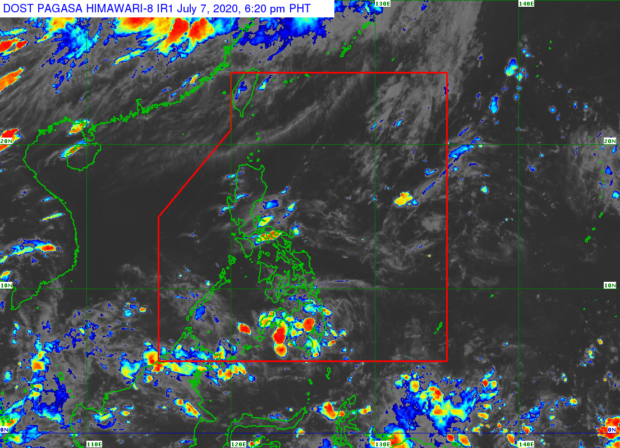
MANILA, Philippines — Sticky weather is on the horizon even if isolated rain showers and thunderstorms remain possible on Wednesday, July 8, the state weather bureau said.
In a weather bulletin released Tuesday afternoon, the Philippine Atmospheric, Geophysical and Astronomical Services Administration (Pagasa) said the humid condition was brought by easterlies or warm winds from the Pacific region.
Nevertheless, Pagasa also noted cloud bands still floating over Visayas and Mindanao. Although none of these cloud bands can develop into a low-pressure area as of now.
“Mapapansin natin na mas madaming ulap ang namumuo sa silangang bahagi […] samantala sa labas ng ating area of responsibility bagamat may mga kumpol na kaulapan, wala naman tayong na-identify na low pressure area na posible ngang maka-apekto sa ating bansa,” senior weather specialist Chris Perez said.
(We can observe that more clouds are being created east of the country. But outside our area of responsibility, even if there are cloud bands being formed, we have not identified any low-pressure area that can affect the country.)
“Bukas patuloy pa rin ang mainit at maalinsangang panahon sa buong bansa, pero may tsansa pa rin ng pulo-pulong dagliang pag-ulan o mga pagkidlat at pagkulog, ‘yong tinatawag nating isolated thunderstorms,” he added.
(Tomorrow, we would still experience hot and humid weather in the country, but there is still a chance of occasional rains and lightning strikes and thunder, or isolated thunderstorms.)
According to Pagasa, Metro Manila will experience temperatures from 25 to 34 degrees Celsius while it will be around 25 to 36 degrees Celsius in Tuguegarao. Weather will be slightly cooler down south, however, as Cebu and Tacloban will see temperatures of 25 to 31 degrees Celsius.
In Mindanao, Davao will feel 25 to 33 degrees Celsius climate while heat in Zamboanga will range from 24 to 33 degrees Celsius.
Pagasa reminded that the recent hot and humid weather is not a sign that the southwest monsoon is no longer prevalent, given that the surface wind forecasts see winds coming from the southeastern part of the country.
Instead, these are just monsoon breaks, Pagasa explained, as the habagat or southwest monsoon has previously extended up to October depending on the wind patterns. This only means that rains and storms within the rainy season are still very much possible, according to the state weather bureau.
Pagasa earlier announced that around three storms could enter the country’s area of responsibility this July.