LPA turns into Tropical Depression Butchoy; Signal no. 1 in NCR, Central Luzon

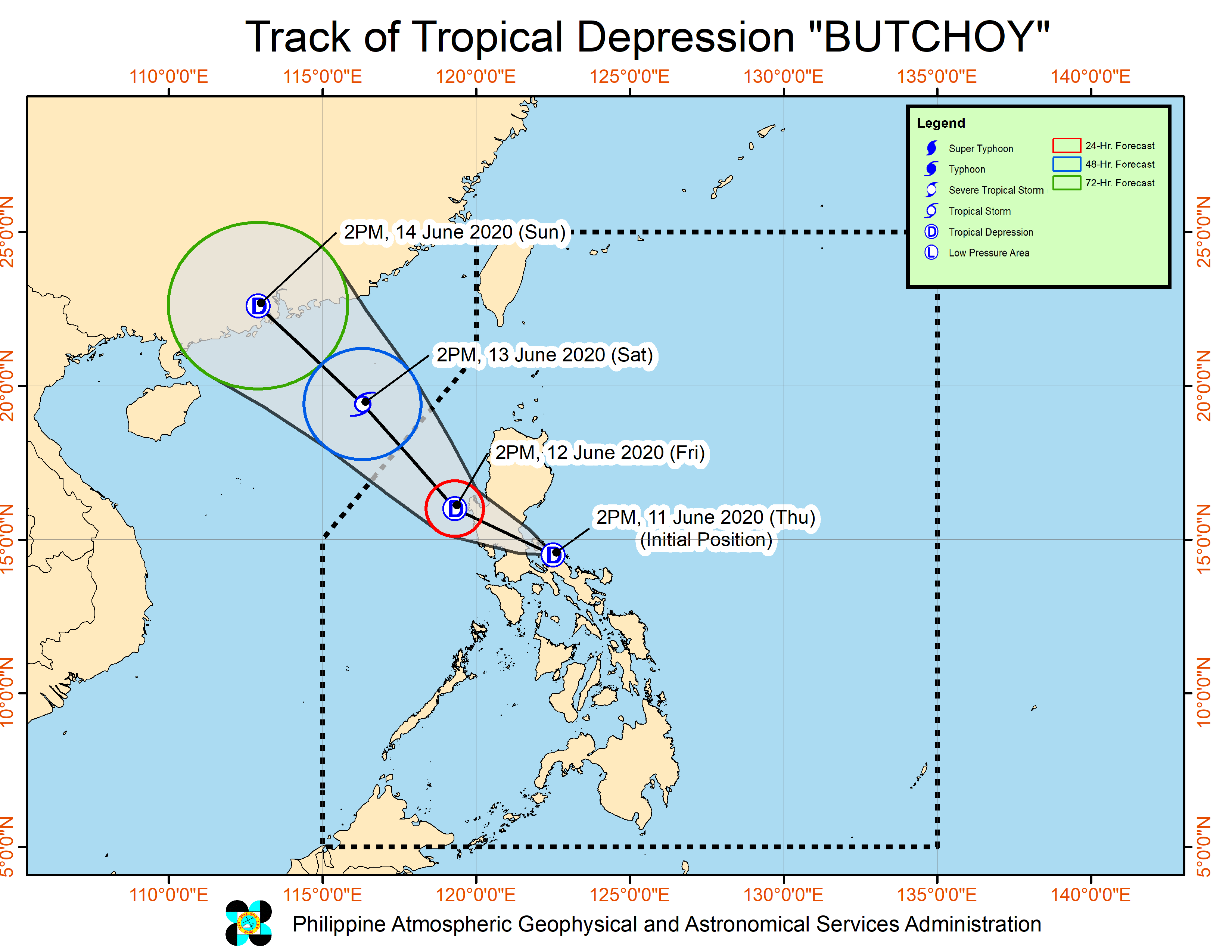
MANILA, Philippines – The low-pressure area being monitored a few days ago has developed into a Tropical Depression called “Butchoy” as of Thursday afternoon, meteorologists from the Philippine Atmospheric, Geophysical and Astronomical Services Administration (Pagasa) said.
Pagasa’s monitoring showed that Butchoy was recently spotted 75 kilometers northwest of Daet, Camarines Norte. It is now packing maximum sustained winds of 45 kilometers per hour (kph) and gustiness of up to 55 kph.
It was seen moving at a west-northwest pattern with a speed of 20 kph.
A Tropical Cyclone Warning Signal No.1 has been raised over Metro Manila, Rizal, the southern portion of Aurora, Pangasinan, Zambales, Bataan, Tarlac, Pampanga, Nueva Ecija, and Bulacan.
But Pagasa reminded that rains are also expected in areas not under any tropical cyclone warning signal as Butchoy intensifies the cloud movements along southwest monsoon or Habagat, bringing rains on other parts of Luzon and Visayas, and even Mindanao.
Article continues after this advertisement“Bagamat nandito pa ‘yong bagyong si Butchoy, dahil nga sa pinag-ibayong Habagat, nakakaranas na rin ng mga pag-ulan hindi lamang ‘yong mga areas over Central and Southern Luzon at bahagi ng Visayas kung hindi pati na rin dito sa western section ng Mindanao,” weather specialist Chris Perez said.
Article continues after this advertisementModerate to heavy rains may be experienced from Thursday afternoon to Friday morning over Calabarzon, Camarines Norte, Camarines Sur, Albay, and the areas under Signal No. 1.
Pagasa expects Butchoy to make landfall on Thursday night and make its way across Central Luzon. It added that Butchoy would be exiting Luzon’s landmass by Friday afternoon through the Pangasinan shores.
By Saturday, Butchoy may be well into the South China Sea, outside the Philippine area of responsibility.