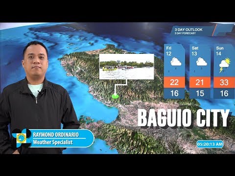
MANILA, Philippines — A low pressure area off Catanduanes is expected to develop into a tropical depression anytime on Thursday, according to the Philippine Atmospheric, Geophysical, and Astronomical Services Administration.
The LPA was last spotted 50 kilometers east-northeast of Virac, Catanduanes or 245 kiloneters north-northwest of Borongan City, Eastern Samar, based on Pagasa’s 4 a.m. weather bulletin.
“Anumang oras ngayong araw ay posible nang maging bagyo ang nasabing low pressure area at tatawagin natin itong bagyong Butchoy,” Pagasa weather specialist Raymond Ordinario said in a weather report.
(Anytime today, the LPA may develop into a tropical depression and will be named Butchoy.)
“Sa ngayon nakikita natin na maapektuhan nito ang Bicol Region area kasama na ang Eastern Visayas, at posible itong tumahak sa Central at Northern Luzon pagdating ng weekend,” he added.
(We can now see that it will affect the Bicol Region and Eastern Visayas, and may traverse through Central and Northern Luzon this weekend.)
According to Pagasa’s weather bulletin, the LPA and the southwesterly windflow will bring cloudy skies with scattered to widespread rains and thunderstorms in Metro Manila, Visayas, Central Luzon, Bicol Region, Calabarzon, Mimaropa, and Isabela.
The LPA and the southwesterly windflow will likewise bring cloudy skies with scattered rain showers and thunderstorms in Mindanao and the rest of Cagayan Valley.
Meanwhile, the rest of Luzon will have partly cloudy to cloudy skies with isolated rainshowers or thunderstorms due to localized thunderstorms, according to Pagasa.
Forecast temperature range in key cities/areas:
- Metro Manila: 24 to 31 degrees Celsius
- Baguio City: 17 to 24 degrees Celsius
- Laoag City: 24 to 33 degrees Celsius
- Tuguegarao: 24 to 33 degrees Celsius
- Legazpi City: 25 to 31 degrees Celsius
- Tagaytay City: 23 to 29 degrees Celsius
- Puerto Princesa City: 25 to 31 degrees Celsius
- Iloilo: 25 to 30 degrees Celsius
- Cebu: 25 to 29 degrees Celsius
- Tacloban City: 24 to 29 degrees Celsius
- Cagayan De Oro City: 24 to 31 degrees Celsius
- Valencia City: 20 to 30 degrees Celsius
- Zamboanga City: 23 to 32 degrees Celsius
- Davao City: 26 to 32 degrees Celsius
