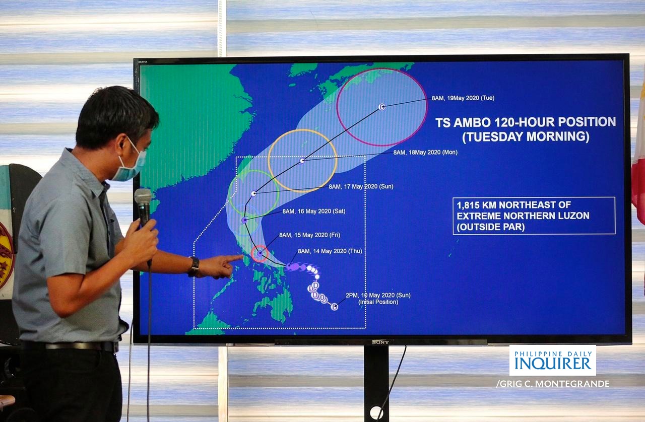
LOOK: Senior weather forecaster Chris Perez gives update on the status of typhoon Ambo on Thursday, May 14 at the PAGASA headquarters in Quezon City. Typhoon Ambo made landfall in San Policarpio, Eastern Samar at 12:15 pm on Thursday. INQUIRER/GRIG C. MONTEGRANDE
MANILA, Philippines — Typhoon Ambo continues to maintain its strength while moving towards the northern portion of Samar, the state weather bureau said Thursday.
Typhoon Ambo is bringing violent winds and heavy to intense rains over the northern portion of Samar and the southern portion of Northern Samar, according to the Philippine Atmospheric, Geophysical, and Astronomical Services Administration in its 5 p.m. weather bulletin.
Pagasa said that TyphoonAmbo was last spotted in the vicinity of San Jose De Buan, Samar.
The typhoon also packed maximum sustained winds of 155 kilometers per hour (kph) near the center and gustiness of up to 255 kph.
Ambo was also monitored moving west at 15 kph.
The state weather bureau said that heavy to at times intense rains are expected over Samar Provinces, Masbate, and Sorsogon. Moderate to at times heavy rains over Albay, Camarines Sur, Catanduanes, and the rest of Eastern Visayas on Thursday.
Meanwhile, Ambo is set to bring moderate to heavy with at times intense rains over Bicol Region, Northern Samar, Quezon, Aurora, Marinduque, and Romblon on Friday.
State meteorologists also warned that a storm surge of two to four meters may be experienced over the coastal areas of Northern Samar, Samar (west coast), Sorsogon, Albay, Catanduanes, Camarines Sur, Camarines Norte, Quezon, and Aurora.
Tropical Cyclone Wind Signal (TCWS) No. 3, where winds of greater than 121 kph up to 170 kph may be expected in at least 18 hours, continues to be hoisted over the following areas:
- Sorsogon
- Albay
- Masbate including Ticao and Burias Islands,
- Catanduanes
- Camarines Sur
- Camarines Norte
- The southernmost portion of Quezon (Tagkawayan, Calauag, Lopez, Macalelon, General Luna, Catanauan, Buenavista, Guinayangan, Mulanay, San Narciso, San Andres, San Francisco)
- Northern Samar
- The northern portion of Eastern Samar (Jipapad, Arteche, Maslog, Dolores, Oras, San Policarpo, Can-avid, Taft, Sulat, San Julian, Borongan City, Maydolong)
- The northern portion of Samar (Calbayog City, Sta. Margarita, Gandara, Pagsanghan, San Jorge, Matuguinao, San Jose de Buan, Catbalogan, Jiabong, Motiong, Paranas, Tarangnan, San Sebastian, Hinabangan)
- Biliran
TCWS No. 2, which winds of greater than 61 kph and up to 120 kph may be expected in at least 24 hours, is raised over:
- The southern portion of Quezon (Mauban, Sampaloc, Lucban, Tayabas, Dolores, Candelaria, Sariaya, Tiaong, San Antonio, Lucena, Pagbilao, Atimonan, Padre Burgos, Agdangan, Unisan, Plaridel, Gumaca, Pitogo, Quezon, Alabat, Perez, Real),
- Marinduque
- Romblon
- Laguna
- The southeastern portion of Batangas (Padre Garcia, Ibaan, Batangas City, Taysan, Rosario, Lobo, San Juan)
- The northernmost portion of Leyte (Calubian, San Isidro, Tabango, Leyte, Capoocan, Carigara, Barugo, San Miguel, Babatngon, Tunga, Alangalang, Sta. Fe, Palo, Tacloban City, Jaro)
- The rest of Samar
- The rest of Eastern Samar
And Pagasa raised TCWS No.1, of which winds of 30 to 60 kph may be expected in at least 36 hours or intermittent rains may be expected within 36 hours, over:
- Metro Manila
- Nueva Ecija
- Bulacan
- Aurora
- Cavite
- Rizal
- Bataan
- Pampanga
- Isabela
- Nueva Vizcaya
- Quirino
- Tarlac
- Zambales
- Oriental Mindoro
- The eastern portion of Pangasinan (Lingayen, Bugallon, Aguilar, Mangatarem, Binmaley, San Carlos, Urbiztondo, Basista, Bayambang, Bautista, Calasiao, Alcala, Malasiqui, Sta. Barbara, Dagupan, Mangaldan, San Jacinto, Mapandan, Manaoag, Urdaneta, Villasis, Sto. Tomas, Rosales, Balungao, Umingan, San Quintin, Sta. Maria, Natividad, Tayug, Asingan, San Nicolas, San Manuel, Binalonan, Laoac, Pozorrubio, Sison, San Fabian)
- The rest of Quezon
- the rest of Batangas
- The rest of northern portion of Leyte (Villaba, Kananga, Matag-ob, Palompon, Ormoc, Merida, Isabel, Ormoc City, Albuena, Pastrana, Dagami, Tanauan, Tabontabon, Tolosa, Barauen, Julita, Dulag)
- The northeastern portion of Capiz (Pilar)
- The northeastern portion of Iloilo (Carles, Balasan, Estancia, Batad)
Northern Cebu (Medelin, Daanbantayan, Madridejos, Bantayan, Santa Fe)