Pagasa issues Samar storm surge warning as Typhoon Ambo rages
MANILA, Philippines — Storm surges of two to four meters may be experienced in coastal areas in the Samar provinces and other areas which “may cause potentially life-threatening coastal inundation” on Thursday due to Typhoon Ambo (international name: Vongfong), according to the Philippine Atmospheric, Geophysical and Astronomical Services Administration (Pagasa).
Pagasa warned that storm surges may hit coastal communities in Northern Samar, Eastern Samar (east coast), Samar (west coast), Sorsogon, Albay, Catanduanes, Camarines Sur, Camarines Norte, Quezon, and Aurora.
“Along with large swells, this storm surge may cause potentially life-threatening coastal inundation,” the weather bureau said in its 11 a.m. severe weather bulletin.
Typhoon Ambo is forecast to make landfall over Northern Samar or the northern portion of Eastern Samar between 12 pm and 2 pm before heading to Sorsogon Thursday evening.
Article continues after this advertisementIt will bring heavy to intense with at times torrential rains over Samar provinces, Masbate, Sorsogon, and Catanduanes.
Article continues after this advertisementModerate to heavy with at times intense rains, meanwhile, will be experienced in Albay, Camarines Sur, and the rest of Eastern Visayas, according to Pagasa.
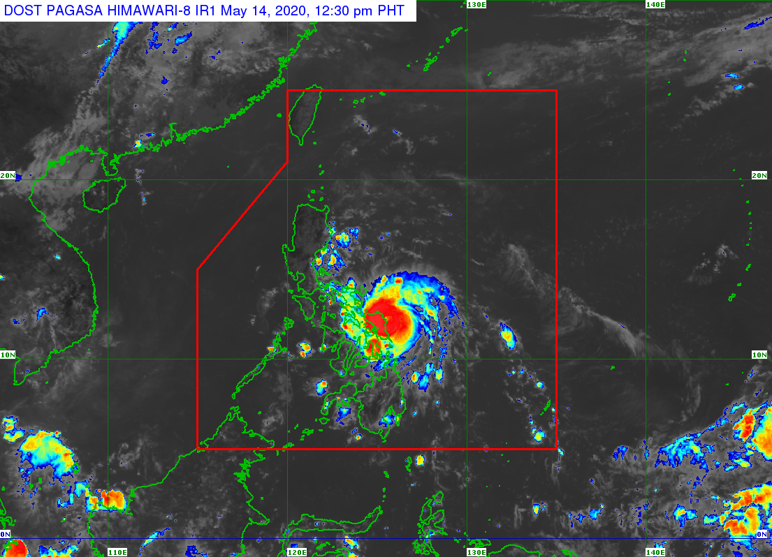
Violent winds and heavy to torrential rains of the eyewall region will begin affecting Northern Samar and the northern portions of Samar and Eastern Samar within 12 hours, according to Pagasa.
At 10 a.m., the eye or center of typhoon Ambo was located 140 kilometers east southeast of Catarman, Northern Samar.
It is moving westward at 15 kilometers per hour (kph) and is packing maximum sustained winds of 150 kph near the center and gustiness of up to 185 kph.
TCWS No. 3, which means winds of greater than 121 kph up to 170 kph may be expected in at least 18 hours, is raised in the following areas:
– Sorsogon
– Albay
– Ticao Island
– Northern Samar
– northern portion of Eastern Samar (Jipapad, Arteche, Maslog, Dolores, Oras, San Policarpio, Can-avid, Taft, Sulat, San Julian, Borongan City, Maydolong)
– northern portion of Samar (Calbayog City, Sta. Margarita, Gandara, Pagsanghan, San Jorge, Matuguinao, San Jose de Buan, Catbalogan, Jiabong, Motiong, Paranas, Tarangnan, San Sebastian, Hinabangan)
TCWS No. 2, which means winds of greater than 61 kph and up to 120 kph may be expected in at least 24 hours, is raised in the following areas:
– southern portion of Quezon (Pagbilao, Atimonan, Padre Burgos, Plaridel, Agdangan, Unisan, Gumaca, Pitogo, Macalelon, Lopez, Caluag, General Luna, Catanauan, Perez, Alabat, Quezon, Tagkawayan, Guinayangan, Buenavista, San Narciso, Mulanay, San Andres, San Francisco)
– Biliran
– the rest of Samar
– the rest of Eastern Samar
Meanwhile, TCWS No. 1, which means winds of 30-60 kph may be expected in at least 36 hours or intermittent rains may be expected within 36 hours, is hoisted in the following areas:
– Aurora
– southern portion of Nueva Ecija (General Mamerto Natividad, Palayan City, Cabanatuan, Santa Rosa, Jaen, San Isidro, San Antonio, Cabiao, Bongabon, Gabaldon, General Tinio, Laur, San Leonardo, Peñaranda, Gapan City)
– northern portion of Leyte (Calubian, San Isidro, Tabango, Villaba, Leyte, Kananga, Capoocan, Carigara, Barugo, San Miguel, Babatngon, Tunga, Jaro, Alangalang, Sta. Fe, Tacloban City, Palo, Pastrana, Dagami, Tabontabon, Tanauan, Tolosa, Ormoc City, Matag-ob, Palompon, Merida, Isabel, Albuera, Burauen, Julita, Dulag)