
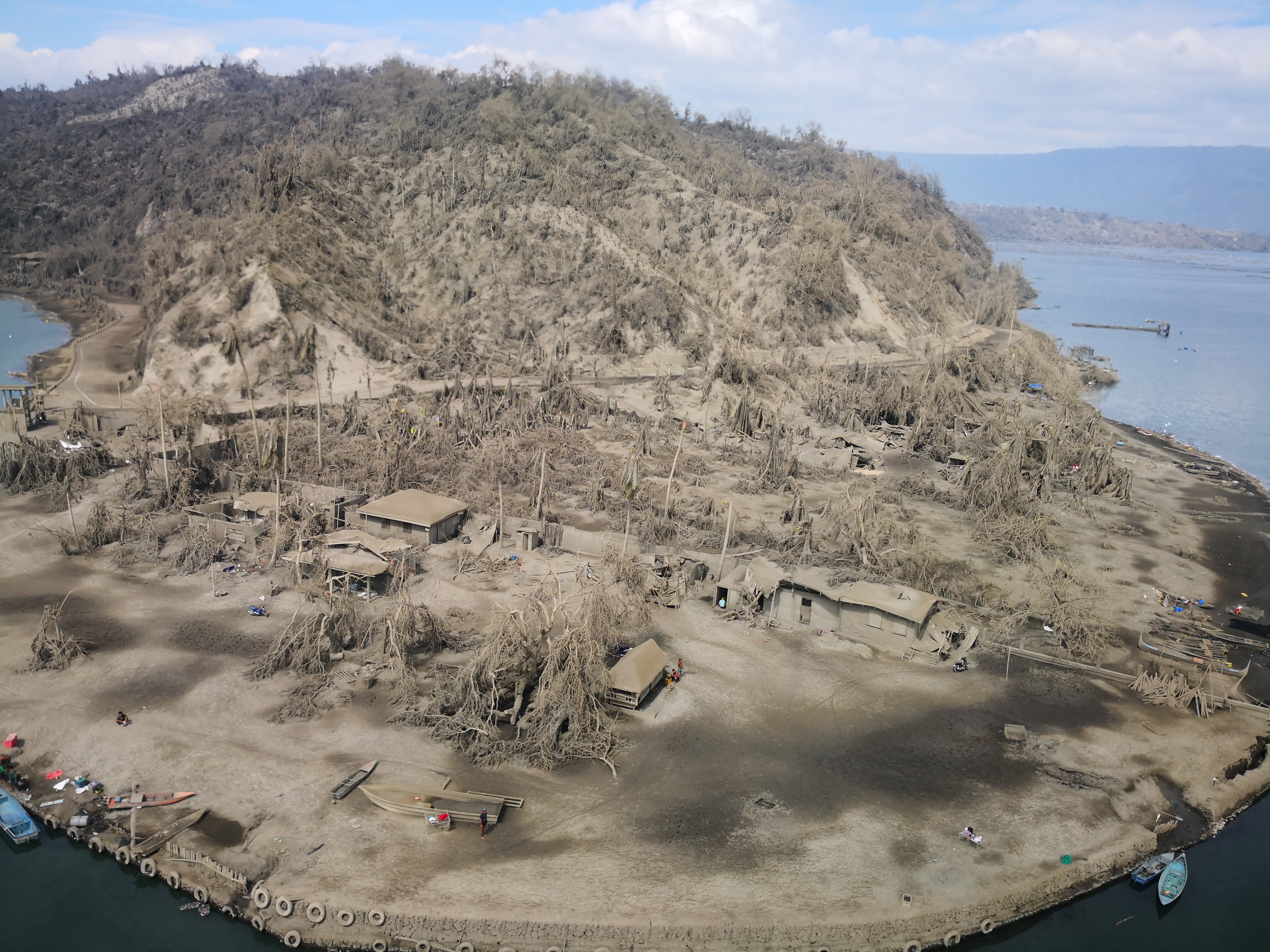
DEVASTATION Disaster management officials see for themselves the devastation caused by massive ashfall on a part of Laurel town, Batangas, during a helicopter flight on Friday over areas close to Taal Volcano. Scientists say the relative calm of Taal over the past fewdays after it belched steam and ash on Jan. 12 did not mean that the danger of a more explosive eruption was over. —CLIFFORD NUÑEZ
Widening fissures in areas around Taal Volcano, a new “steaming” fissure on the northern side of Volcano Island and hundreds of earthquakes were signs of rising magma that may result in an explosive eruption, scientists said on Friday.
The Philippine Institute of Volcanology and Seismology (Phivolcs) said the water of the entire Taal Lake also was receding, and this could be attributed to ground deformation caused bby magma trying to reach the surface.“Steam rising from the fissure is another indication that there is still magma pushing upwards,” said Mariton Bornas, chief of Phivolcs’ Monitoring and Eruption Prediction Division.There were at least five “discrete weak explosions” recorded by the Taal Volcano Network on Friday.
Fissures are cracks on the ground that appear after a volcanic eruption. They are caused by ground deformation as the earth’s surface is pushed upwards by magma.
Nearly 700 volcanic earthquakes have been recorded since Taal belched plumes of steam and ash last Sunday, strong indications of continuous magmatic intrusion beneath Taal.
Temblors
These temblors point to possible further eruptive activity, Phivolcs said.
The existing fissures in the towns on the southern shores of Taal Lake—Lemery, Agoncillo, Talisay and San Nicolas—have widened by a few centimeters, Phivolcs said.
They include those that appeared in the barangays of Sambal Ibaba, Sinisian, Mahabang Dahilig, Dayapan, Palanas, Sangalang, Poblacion and Mataas na Bayan in Lemery; Pansipit and Bilibinwang in Agoncillo; Poblacion 1, Poblacion 2, Poblacion 3, Poblacion 5 in Talisay; and Poblacion in San Nicolas.
Bornas said that while surface volcanic activity had eased, this did not mean that the danger had passed.
“We cannot determine the movement of the magma underneath. It could come up very suddenly,” she said.
Despite the possible explosive eruption, scientists said it was highly unlikely that the Taal caldera, where the Taal Lake sits, would itself erupt, crushing rumors about this catastrophic occurrence circulating on social media.
Based on all existing data and parameters, the Phivolcs is not worried about the entire caldera erupting, said Bornas, noting that the unrest was concentrated on the main crater on Volcano Island.
“Please do not alarm our countrymen that the caldera will erupt because the repose period of a caldera is measured in hundreds of thousands of years,” she told reporters.
The towns of Lemery, Agoncillo, Talisay, San Nicolas, Laurel, Sta. Teresita, Cuenca, Lipa, Mataasnakahoy, Balete, the eastern part of Malvar, and some parts of Tanauan City form part of the Taal caldera ring.
Caldera not erupting
A caldera is formed when magma is ejected or withdrawn from its reservoir deep in the earth, forming a large basin-shaped ground depression with a diameters ranging from two to 50 kilometers.
“Based on indications at present, it is not likely that the caldera will also erupt, but if you ask if it is possible, yes, since a cataclysmic eruption was what created the caldera hundreds of thousands of years ago in the first place,” said Mario Aurelio, director of the National Institute of Geological Sciences.
Speaking to the Inquirer by phone from Taal, Aurelio said the worst recorded eruption of the volcano was also its longest—seven months in 1754.
The 1977 eruption lasted just a few days, which was the “less bad” scenario, he said.
Aurelio said it was “very difficult to determine” whether the 1754-type eruption might again occur since everything was a matter of estimation.
“It’s possible to make an estimation of how much magma is left in the magma chamber, but that requires a lot of data and measurements, not to mention surveying, all of which cannot be done during an active eruption, since it is too risky,” he said.
Warning on social media
Aurelio said it was crucial to get accurate and timely information from the right sources.
“Regarding social media posts and text messages, it’s better to not believe them, and get information directly from the Phivolcs since they are the ones who know best. You also do not know who these people are who might be spreading misinformation,” Aurelio said.
To help get the right information out Phivolcs has been working closely with its international partners.
It has linked anew with the US Geological Survey (USGS) Volcano Disaster Assistance Program, which helped the country’s experts during the Mt. Pinatubo eruption in 1991.
“We have almost the same assessment (of the Taal situation) … and we shared the same insights in interpreting the data and in improving our monitoring,” Bornas said.
The Volcano Disaster Assistance Program was established to aid foreign partners in monitoring volcanoes and to strengthen response capacities in 12 countries.
Bornas said scientists from other countries have also reached out to Phivolcs to share their expertise.
“They are working with us behind the scenes because they know the difficulty of handling a volcanic crisis,” she said. “Volcanologists who work with and deal with volcanoes similar to Taal really offered their help to us.”Bornas said Phivolcs has obtained satellite images from the USGS showing the individual vents or craters that have already appeared inside the main crater after the crater lake dried up earlier this week. She said they are working with the USGS to release them to the public. —WITH A REPORT FROM JHESSET O. ENANO