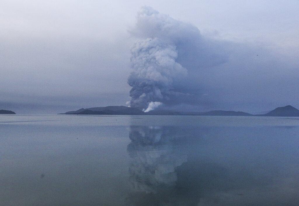
Taal volcano spews ash in view from Batangas on Monday. Red-hot lava gushed out of a volcano as thousands of people fled the area through heavy ash. Experts observe the lava fountain has weakened. (AP)
MANILA, Philippines – Specialists of the Philippine Institute of Volcanology and Seismology (Phivolcs) observed that the Taal Volcano’s lava fountain weakened as of Monday night.
However, they also warned the public especially residents of towns in Batangas and Cavite that it is not a sign that the restive volcano — which erupted on Sunday afternoon — is slowing down and safe again.
“The lava fountaining we have observed, now we cannot see it based on the observations of our personnel on the field,” Phivolcs’ science research specialist Jerome de Lima said in an interview with DZMM on Tuesday morning.
“It’s unlike yesterday where it suddenly spewed lava. As of now, this brief silence shouldn’t be considered as a sign Taal Volcano is calming down. We should still be cautious because the Taal Volcano’s activities may change in the coming days,” he added.
Geologists and volcanologists generally consider lava fountains as a sign that a hazardous eruption is imminent. Phivolcs raised Alert Level 4 on Taal Volcano last Sunday, after it emitted ash clouds that reached as far as Metro Manila, and Central and Northern Luzon.
The lava fountains were observed as early as 4:00 a.m. of Monday, January 13, while Phivolcs said that new lateral vents were discovered along the northern flank of Taal Volcano. Short lava fountains measuring up to 500 meters were observed, Phivolcs said.
LOOK: Lava fountain from Taal Volcano
READ: Lava fountains now emanating from Taal Volcano’s northern flank
According to Phivolcs’ classifications of alert levels for Taal, Alert Level 4 is characterized by “intense unrest, continuing seismic swarms, including harmonic tremor and/or low frequency earthquakes”.
De Lima said that the direction of the ash clouds also changed, with winds moving southwest to west, therefore possibly affecting the Batangas towns of Cuenca, Lemery, and Taal.
“Taal Volcano continues to spew ash, and the current direction is southwest to west, while Taal’s ash column’s height ranges from 800 meters to two kilometers,” De Lima said.
Earlier, it was reported that more than 40 earthquakes have occurred in Batangas and Cavite towns since the Magnitude 4.0 in Talisay, Batangas on Monday night was recorded.
Among the strongest earthquakes within the six-hour span include a shallow, Magnitude 3.6 quake in Taal, where Intensity III was felt in Tagaytay; and a Magnitude 3.9 quake in Talisay, where Intensity IV was experienced in Tagaytay also.
Earlier, Phivolcs science research assistant Benz Rodriguez said in a radio interview with DZMM that even if the Talisay earthquake was tectonic by origin, the series of earthquakes were mostly caused by the activities of the Taal Volcano.
A family evacuates to safer grounds as Taal volcano in Tagaytay City, Cavite province on Monday. (AP)
READ: Phivolcs’ more detailed earthquake information
READ: Batangas town hit by Magnitude 4.0 quake; Phivolcs points to Taal Volcano as cause
READ: Taal Volcano erupts