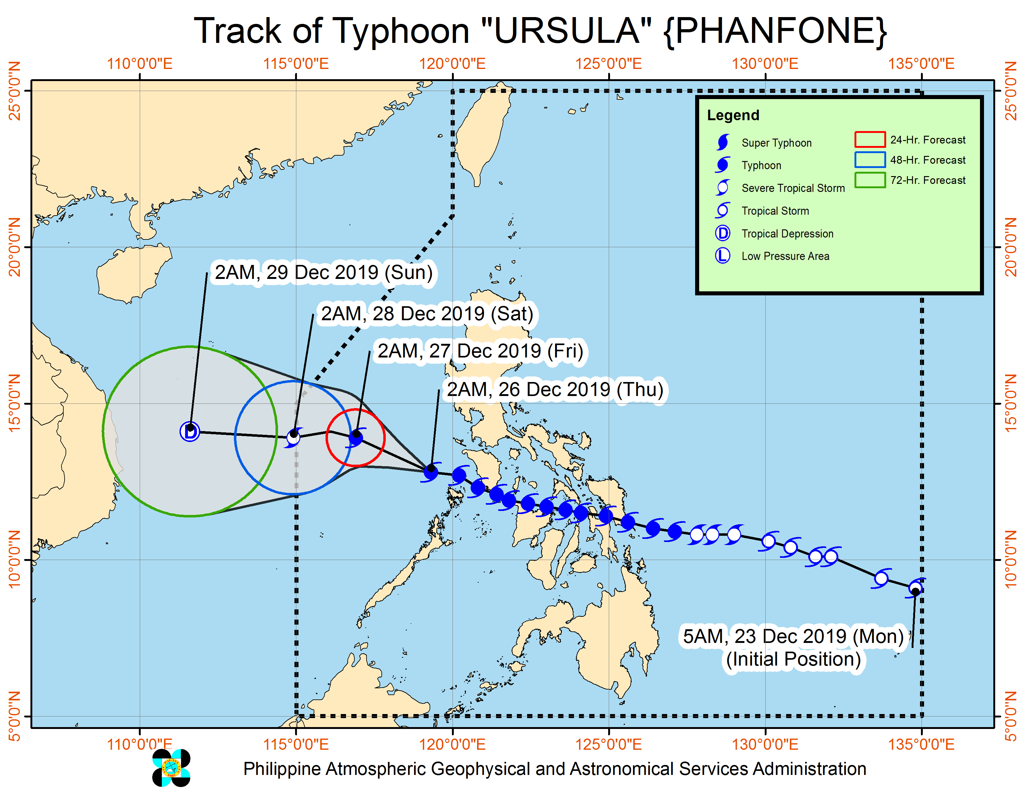
MANILA, Philippines — Typhoon Ursula has slightly slowed down, and its center is now over the West Philippine Sea, the state weather bureau said Thursday.
In its 5 a.m. live weather update, the Philippine Atmospheric, Geophysical and Astronomical Services Administration (Pagasa) said that Ursula was last spotted at 155 kilometers northwest of Coron, Palawan.
Ursula packed maximum sustained winds of 130 kilometers per hour (kph) near the center, and gustiness of up to 160 kph.
The typhoon was also monitored moving west-northwest at 15 kph.
Pagasa said that Ursula is expected to exit the Philippine Area of Responsibility (PAR) within 48 hours.
According to Pagasa, the Tropical Cyclone Wind Signal (TCWS) was lifted in the Northwestern portions of Aklan and Antique, Western portion of Romblon, Marinduque, Southwestern portion of Quezon, Laguna, and some portions of extreme northern Palawan, including Cuyo Islands.
Meanwhile, TCWS No. 1 was still raised over Bataan, Cavite, Batangas, Oriental Mindoro, Occidental Mindoro, including Lubang Island and extreme northern Palawan (Linapacan, El Nido).
Occasional to frequent heavy rains may be experienced over Calamian Islands and Occidental Mindoro, including Lubang Island.
Light to moderate with intermittent heavy rains was forecast over Oriental Mindoro, rest of extreme northern Palawan, Calabarzon, Metro Manila, and Central Luzon.
