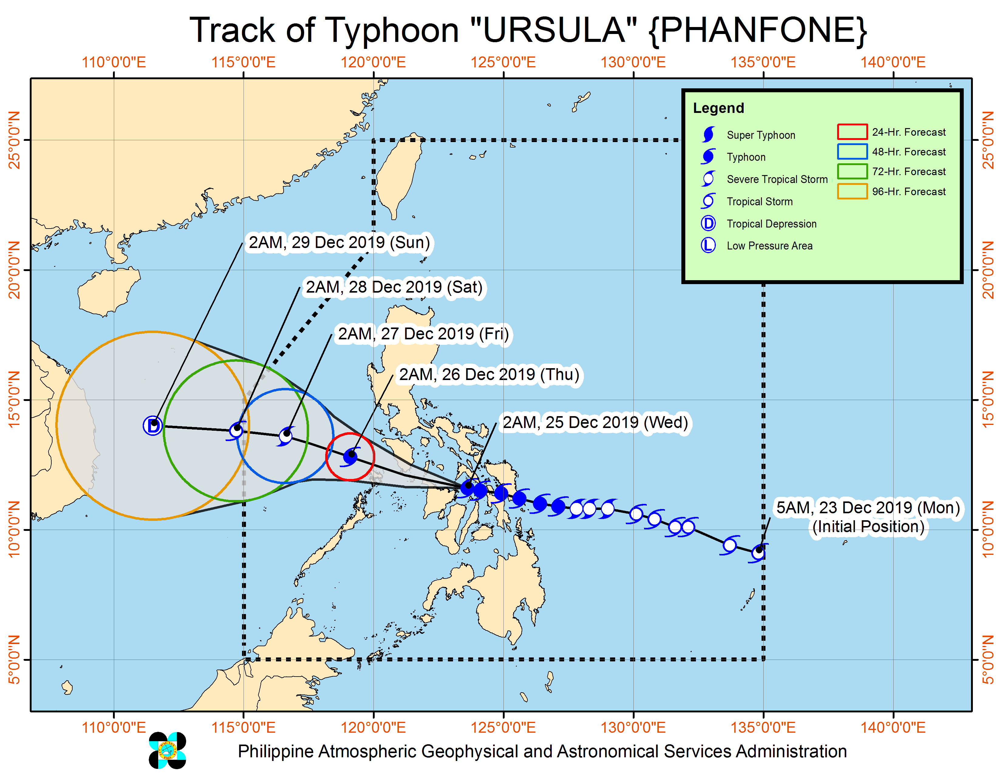
MANILA, Philippines—Typhoon Ursula (international name: Phanfone) slightly intensified as it crossed Jintotolo Channel north of Iloilo early Christmas Day, the Philippine Atmospheric, Geophysical and Astronomical Services Administration (Pagasa) reported.
As of 4 a.m., the storm was seen 40 kilometers east-northeast of Roxas City, Capiz, packing maximum sustained winds of up to 140 kilometers per hour near the center and gusts of up to 195 kph. It was moving west-northwest at 25 kph.
The eyewall of Ursula was bringing “very destructive winds and intense rainfall over southern Masbate, Capiz and northeastern Iloilo”, the weather state bureau said.
It warned that Romblon, Aklan and northern Antique would be affected by the eyewall in the coming hours.
Heavy to intermittent intense rains may occur over Masbate, extreme northern Cebu, northern Negros Provinces, Aklan, Antique, Capiz, Iloilo, Guimaras, Romblon, Calamian Islands, Cuyo Islands, and Mindoro provinces, Pagasa said.
Meanwhile, light to moderate rains with isolated heavy rain showers may be experienced over Bicol Region, the rest of Visayas, Calabarzon, Marinduque, Aurora and the northern portion of mainland Palawan on Wednesday.
A storm surge of up to two meters high may affect several coastal areas in extreme northern Cebu, Masbate, Aklan, Capiz, Northern Antique, northeastern Iloilo, Romblon, Marinduque, and Mindoro Provinces, Calamian Islands and Cuyo Islands.
The typhoon made landfall in Salcedo, Eastern Samar (4:45 p.m. Tuesday); Tacloban City, Leyte (7:30 p.m. Tuesday); Cabucgayan, Biliran (9:15 p.m. Tuesday); Gigantes Islands, Carles, Iloilo (2:30 a.m. Wednesday).
Pagasa said Ursula will be 150km northwest of Coron, Palawan by Thursday morning.
Tropical Cyclone Wind Signal No.3 is hoisted in the following areas:
- Masbate
- Ticao Island,
- Romblon,
- southern Oriental Mindoro
- southern Occidental Mindoro
- extreme northern Cebu
- Bantayan Island
- Capiz
- Aklan
- northern Antique
- northern Iloilo
Signal No. 2
- Southern Quezon
- Marinduque
- the rest of Oriental Mindoro
- the rest of Occidental Mindoro
- Lubang Island
- Albay
- Sorsogon
- Burias Island
- Calamian and Cuyo Islands
- Biliran
- northwestern Leyte
- Northern Samar
- Samar
- the rest of northern Cebu
- Camotes Islands
- central Cebu
- the rest of Iloilo
- the rest of Antique
- Guimaras
- northern Negros Occidental
Signal no. 1
- Bataan
- Metro Manila
- Rizal
- Cavite
- the rest of Quezon
- Laguna
- Batangas
- Camarines Sur
- Camarines Norte
- Catanduanes
- northern mainland Palawan
- Eastern Samar
- the rest of Leyte
- Southern Leyte
- Bohol
- Siquijor
- the rest of Cebu
- the rest of Negros Occidental
- Negros Oriental