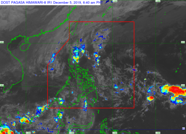
Storm Tisoy weakens further, exiting PAR
MANILA, Philippines — Tropical Storm Tisoy weakened further as it continues to move away from the country, the Philippine Atmospheric, Geophysical and Astronomical Services Administration (Pagasa) reported Thursday morning.
According to the state weather bureau’s 5 a.m. bulletin, Tisoy was spotted 540 kilometers west of Subic, Zambales with maximum sustained winds of 65 kilometers per hour (km/h) near the center and gustiness of up to 80km/h.
It is moving northwest at 15 km/h. and is forecast to exit the Philippine Area of Responsibility (PAR) Thursday morning.
While Tisoy no longer has a direct effect on the country, the tail-end of a cold front will affect the eastern portion of Northern and Central Luzon while the northeast monsoon will affect the rest of Northern Luzon.
Pagasa said cloudy skies with moderate to occasionally strong rain showers are expected in the Cordillera Administrative Region and Cagayan Valley, including Aurora province.
Meanwhile, the northeast monsoon will bring light to moderate rain showers to Northern Luzon.
The rest of the country, including Metro Manila, is expected to have generally fair weather, with localized thunderstorms in the afternoon and evening.
Pagasa has raised gale warning over Batanes, Cagayan including Babuyan Island, Isabela, Aurora, western coast of Palawan, Occidental Mindoro, eastern coast of Quezon including Polilio Island and Camarines provinces, Catanduanes, Ilocos Norte, Ilocos Sur, La Union, Pangasinan, Zambales, and Bataan.
GSG
