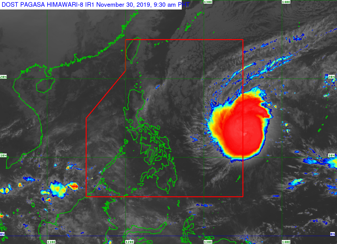
MANILA, Philippines — Typhoon Kammuri continues to gather strength as it is set to enter the Philippine Area of Responsibility (PAR) either Saturday or Sunday, the state weather bureau said.
In its 4 a.m. weather bulletin, the Philippine Atmospheric, Geophysical and Astronomical Services Administration (Pagasa) said Kammuri was last spotted at 1,315 kilometers east of Southern Luzon.
Kammuri is packing maximum sustained winds of up to 150 kilometers per hour (kph) near the center, and gustiness of 185 kph.
The typhoon was also monitored moving west at 20 kph.
Pagasa said the typhoon is set to enter PAR either Saturday, the opening day of the 30th Southeast Asian (SEA) Games, or Sunday morning.
Once the typhoon enters the country, it will be given the local name Tisoy, Pagasa said.
‘Amihan’ over Luzon
The northeast monsoon or amihan, meanwhile, will bring cloudy skies over Luzon.
The Cordillera Administrative Region, Cagayan Valley, and the provinces of Aurora and Quezon will have cloudy skies with scattered rains due to the amihan.
Partly cloudy to cloudy skies with isolated rains is expected over Metro Manila and the rest of Luzon, the state weather bureau said.
As for Palawan, Visayas and Mindanao, Pagasa forecasted that these areas will have partly cloudy to cloudy skies with isolated rain showers due to localized thunderstorms.