TD Ramon maintains strength as it crosses Ifugao
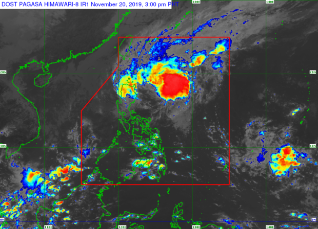
Satellite image from Pagasa
MANILA, Philippines — Tropical Depression Ramon has kept its strength as it traverses Ifugao on Wednesday afternoon, the Philippine Atmospheric, Geophysical, and Astronomical Services Administration (Pagasa) said.
According to Pagasa’s 2 p.m. weather bulletin, Ramon was in the vicinity of Aguinaldo, Ifugao by 1 p.m. and moving south at 20 kilometers per hour (kph).
Pagasa said Ramon was packing maximum sustained winds of 55 kph near the center and gustiness of up to 90 kph even as it is forecast to weaken into a low-pressure area within 24 hours.
Strong to gale force winds, caused by the surge of the northeast monsoon, will prevail over Batanes and the Babuyan Islands, the state weather bureau noted, that light to moderate with occasional heavy rains may be anticipated in these areas as well as Apayao, and the northern portion of Ilocos Norte.
Meanwhile, the state weather bureau said Ilocos Sur, Abra, Kalinga, Mt. Province, Ifugao, Isabela, La Union, Benguet, Nueva Vizcaya and the rest of Ilocos Norte may have light to moderate with intermittent heavy rains.
Article continues after this advertisementPagasa advised residents in these areas, especially those living in areas identified to be susceptible to flooding and rain-induced landslides, to take precautionary actions.
Article continues after this advertisementPagasa has likewise said Signal No. 1 is still in effect over Batanes; Cagayan including the Babuyan Islands; Apayao; Kalinga; Abra; Ilocos Norte; Ilocos Sur; Western portion of Isabela, particularly Quezon, Mallig, Quirino, Roxas, San Manuel, Burgos, Aurora, Reina Mercedes, Luna, Cabatuan, San Mateo, Cauayan, Ramon, Alicia, Angadanan, San Isidro, Santiago, and Cordon; Mountain Province; Benguet; Ifugao; La Union; and Pangasinan.
Pagasa warned that sea travel is risky, especially for small sea crafts, over the seaboards of areas under the tropical cyclone wind signal, as well as seaboards of Camarines Norte and Catanduanes, the eastern seaboards of northern Aurora and Isabela, the western seaboards of Zambales, Bataan, Occidental Mindoro and Palawan, and the northern seaboard of Camarines Sur.
Pagasa explained this is due to rough sea conditions triggered by Ramon, tropical storm Sarah, and the northeast monsoon.
Meanwhile, Sarah was last seen some 715 km east of Infanta, Quezon or at 640 km east of Casiguran in Aurora at 10 a.m. Wednesday.