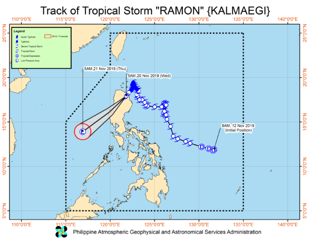
From Pagasa website
MANILA, Philippines — Tropical depression Sarah has intensified into a tropical storm while tropical storm Ramon weakened into a tropical depression before noon Wednesday, the Philippine Atmospheric, Geophysical, and Astronomical Services Administration (Pagasa) said.
As of 10 a.m., Sarah was spotted 715 kilometers east-northeast of Infanta, Quezon or 640 kilometers east of Casiguran, Aurora., according to the 11 a.m. bulletin of the state weather bureau.
Pagasa said Sarah currently travels towards the northwest direction at 20 kilometers per hour (kph), packing maximum sustained winds of 65 kph near the center and gustiness of up to 80 kph.
Meanwhile, Pagasa said Ramon is forecast to weaken into a low-pressure area (LPA) within the next 24 hours.
Moving south-southwest at 20 kph, Ramon was last seen in the vicinity of Roxas, Isabela, packing maximum sustained winds of 55 kph and gustiness of 90 kph.
Satellite image from Pagasa
Meantime, Pagasa hoisted Signal No. 1 over the eastern portion of Cagayan, particularly in Calayan, Aparri, Baggao, Alcala, Gattaran, Lal-lo, Tuguegarao City, Penablanca, Iguig, Amulung, Santa Teresita, Camalaniugan, Santa Ana, Gonzaga, Buguey, and Ballesteros; the northeastern portion of Isabela, specifically Divilacan, Tumauini, Cabagan, Maconacon, and San Pablo.
Pagasa said these areas may experience winds of 30 to 60 kph as well as rains for more or less within 36 hours.
Pagasa also said light to moderate with occasional heavy rains may prevail over Batanes, Cagayan – including Babuyan Islands, Apayao, and the northern portion of Ilocos Norte.
On the other hand, Pagasa noted that Ilocos Sur, Abra, Kalinga, Mt. Province, Ifugao, Isabela, La Union, Benguet and the rest of Ilocos Norte may have light to moderate with intermittent heavy rains.