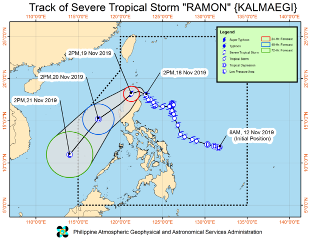

MANILA, Philippines — Ramon has strengthened into a “severe” Tropical Storm ahead of its anticipated landfall in Northern Cagayan between Monday night and Tuesday morning, the Philippine Atmospheric, Geophysical and Astronomical Services Administration (Pagasa) said on Monday afternoon.
As of 4 p.m., the state weather bureau said Ramon was spotted 125 kilometers east of Aparri in Cagayan province packing maximum sustained winds of 100 kilometers per hour (kph) near the center and gustiness of up to 125 kph as it moves north-northwest at 10 kph.
With this, Pagasa maintained its Tropical Cyclone Wind Signal No. 2 for Cagayan including Babuyan Islands, the northern portion of Isabela (Sta. Maria, San Pablo, Maconacon, Cabagan, Sto. Tomas, Quezon, Delfin Albano, Tamauini, and Divilacan), Apayao, Kalinga, and Ilocos Norte.
Pagasa also said Batanes, Ilocos Sur, Abra, Mountain Province, Benguet, Ifugao, La Union, Northern Aurora (Dilasag, Casiguran, and Dinalungan), and the rest of Isabela remain under Signal No. 1.

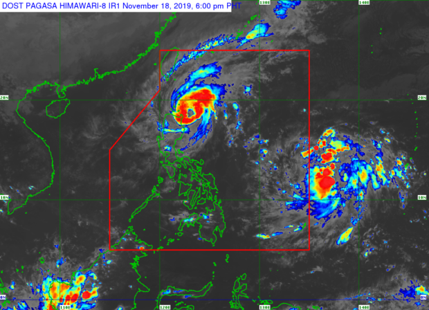
Satellite image from Pagasa
On Monday evening, expect moderate with occasional to frequent heavy rains over Cagayan including the Babuyan Islands, Batanes, the northern portion of Isabela, Ilocos Norte and Apayao, according to the state weather bureau.
Likewise, it said, light to moderate with intermittent heavy rains may be experienced in the rest of Ilocos Norte as well as Isabela, Kalinga, Abra, and Ilocos Norte.
As this developed, Pagasa noted that another low-pressure area (LPA) is approaching the Philippine Area of Responsibility (PAR).
It said that as of 2 p.m., the LPA was located 1,320 km east of Eastern Visayas and is seen to enter PAR within 24 hours.
Edited by KGA