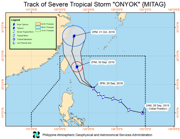
MANILA, Philippines — Severe Tropical Storm “Onyok” further intensified on Sunday afternoon, the Philippine Atmospheric, Geophysical, and Astronomical Services Administration (Pagasa) said.
As of 4 p.m., “Onyok” was spotted 455 kilometers east of Calayan town in Cagayan with maximum sustained winds of 110 kilometers per hour (kph) and gustiness of 135 kph.
It continues to move northwest at a speed of 25 kph.
Onyok remains “less likely” to make landfall in the country and is expected to exit the Philippine area of responsibility (PAR) on Monday evening.
However, Tropical Cyclone Wind Signal No. 1 is still raised over Batanes and the Babuyan Islands.
The storm’s trough or extension will bring scattered light to moderate rain showers and thunderstorms over Cagayan Valley, Apayao, and Ilocos Norte between Sunday and Monday afternoon.
“Sea travel is risky, especially for small seacrafts, over the northern and eastern seaboards of Luzon, including those areas under Tropical Cyclone Wind Signal #1, due to potentially rough sea conditions,” Pagasa warned.
/atm
