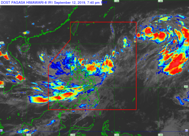
According to weather specialist Ariel Rojas of the Philippine Atmospheric, Geophysical, and Astronomical Services Administration (Pagasa), flashfloods and landslides are possible due to the wide cloud circulation that Marilyn brings with it.
Latest data showed that Marilyn maintains its maximum wind of 55 kilometers per hour (kph) and gustiness of up to 70 kph. Pagasa said the weather disturbance was last seen 1,260 kilometers east-northeast of Casiguran, Aurora, and moving at a speed of 25 kph.
Marilyn is still not expected to hit land although it may intensify into a Tropical Storm within 48 hours.
Marilyn’s speed is fast compared to other weather disturbances, and is likely to exit the Philippine area of responsibility by Sunday afternoon, according to Pagasa. Rojas explained that this is because of the storm’s zigzag movement as it goes on along the eastern boundary of the country.
“Medyo erratic ‘yong kanyang movement, ‘yong weather outputs ng ibang weather agencies, ‘yong kanilang forecast track napaka-labo po,” Rojas said during Pagasa’s weather update.
“Ito po ay na-a-attribute natin sa kanyang malawak na sirkulasyon and normally kapag mahihina po ang mga weather systems gaya ni Tropical Depression Marilyn, ay talagang mahirap i-track ang kanyang magiging pagkilos,” he added.
Nevertheless, Pagasa raised gale warnings in the eastern seaboards of Visayas and Mindanao, as well as in the bodies of water between the two areas.
Pagasa said those areas are highly susceptible to flooding and landslides so residents must coordinate with local disaster risk reduction management offices, and stay tuned for their updates. /kga