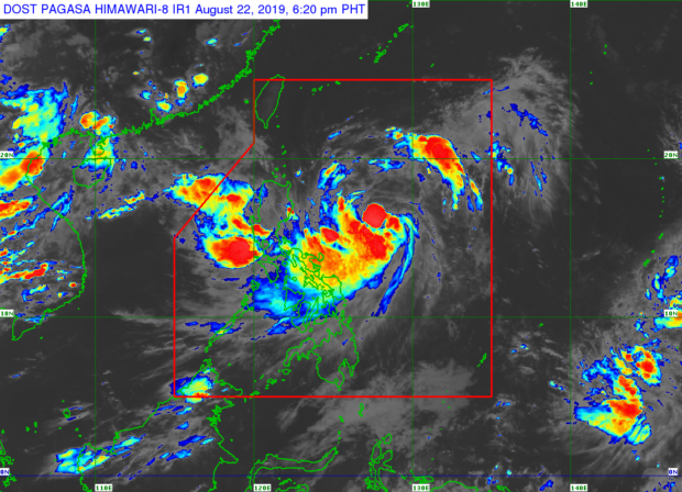
The Philippine Atmospheric, Geophysical, and Astronomical Services Administration (Pagasa) said Ineng was last spotted 670 kilometers east of Casiguran, Aurora and was moving west-northwest at a slower pace – from 15 kilometers per hour (kph) to 10 kph.
Weather Specialist Ana Clauren, however, said Ineng is still not expected to make landfall and would likely leave the Philippine area of responsibility (PAR) by Saturday night or Sunday morning.
Pagasa said Ineng packs maximum sustained winds of 75 kph and gustiness of up to 90 kph, and affects the overall weather in most parts of the country especially Luzon, as its outer rainbands hover in the eastern portion of Southern Luzon and Visayas provinces.
Ineng also strengthens the southeast monsoon or habagat, bringing light to moderate and sometimes heavy rains on the western side of the country, according to Pagasa.
Tropical Cyclone Wind Signal (TCWS) Warning #1 are still up over Batanes, Cagayan including the Babuyan Group of Islands, Isabela, Apayao, Kalinga, Northern Abra, and Ilocos Norte, said Pagasa.
Pagasa also warned of flash floods and landslides in Catanduanes province due to light to moderate and occasional heavy rains brought by Ineng.
Meanwhile, parts of Metro Manila, Ilocos Region, Cordillera Administrative Region, Zambales, Bataan, Cavite, Batangas, Mindoro provinces, Northern Palawan, Antique, Aklan, and rest of Bicol region will experience moderate rains due to the enhanced southeast monsoon, Pagasa said.
Sea travel remained risky over the eastern seaboards of Central and Southern Luzon, and of Visayas, Pagasa added. /kga