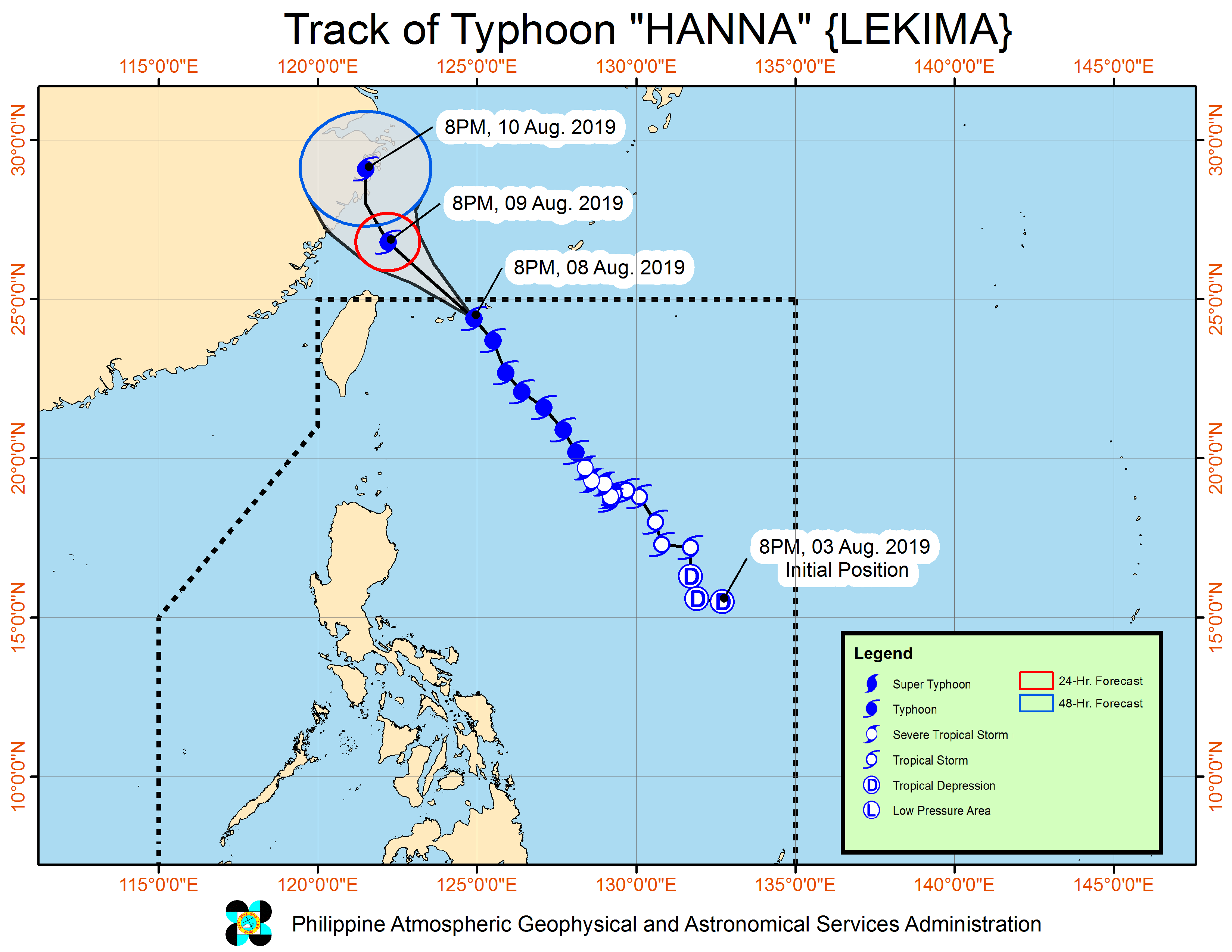
MANILA, Philippines — Typhoon “Hanna” (international name: Lekima) has slightly weakened and is now outside of the Philippine Area of Responsibility (PAR), the weather bureau said Friday.
In its severe weather bulletin, the Philippine Atmospheric, Geophysical and Astronomical Services Administration (Pagasa) said “Hanna” exited the country at 12:30 a.m. on Friday.
At present, “Hanna” is packing maximum sustained winds of 175 kilometers per hour (kph) near the center and gusts of up to 215 kph.
It was last spotted 645 kilometers (km) north northeast of Basco, Batanes at 4:00 a.m., moving north northwest at 20 kph, Pagasa said.
Moderate to heavy monsoon (habagat) rain is expected over Ilocos Region, Cordillera Administrative Region, Batanes, the Babuyan Group of Islands, Zambales, Bataan, Occidental Mindoro and northern portions of Palawan (including Calamian Islands).
Meanwhile, light to moderate with intermittent heavy monsoon rain will be felt over Metro Manila, Western Visayas, and the rest of CALABARZON (Cavite, Laguna, Batangas, Rizal, Quezon), Central Luzon, and MIMAROPA (Mindoro, Marinduque, Romblon, Palawan).
On Saturday, light to moderate with intermittent heavy monsoon rain may also be felt in the Ilocos Region, Cordillera Administrative Region, Zambales and Bataan, Pagasa said.
It added that gusty conditions will continue over most of Luzon and Visayas due to the enhanced “habagat.”
Sea travel, Pagasa warned, is risky over the seaboards of Luzon and Visayas and the northern and eastern seaboards of Mindanao because of potentially rough seas.
Typhoon “Krosa,” another typhoon that Pagasa is monitoring, was last spotted at 1,990 km east of extreme northern Luzon, packing maximum sustained winds of 155 kph near the center and gusts of up to 190 kph.
Pagasa said “Krosa” is moving east slowly and is not expected to enter PAR, Pagasa said. /muf
