In Baguio, land sales, danger zones reviewed amid boom
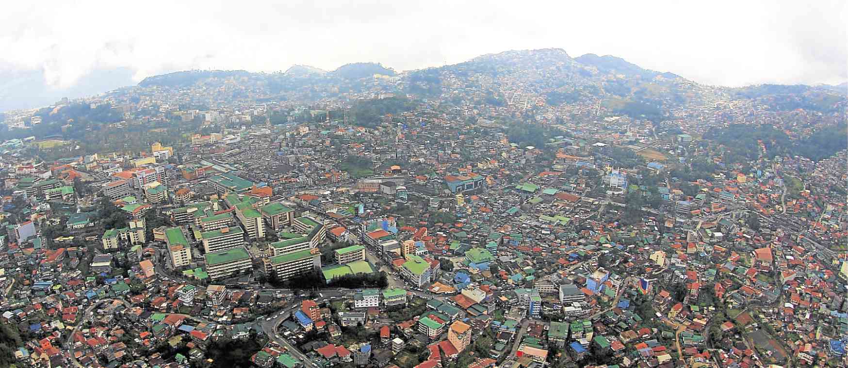
CROWDED Baguio has become a multicultural city in the Cordillera, but over development and population growth now plague the country’s summer capital. —EV ESPIRITU
BAGUIO CITY—How many property owners are there in this city, and how much more land can an overdeveloped Baguio afford to sell?
Officials of the city government and the Department of Environment and Natural Resources (DENR) have turned their attention to Baguio real estate, given a public outcry on a construction boom that threatens its remaining pine forest cover.
Unlike the rest of the country, Baguio is a townsite reservation which classifies all habitable lands as “alienable and disposable.”
But this city was designed for a core population of 25,000 people by the American colonial government, which built and developed Baguio into a chartered city in 1909.
Townsite
Article continues after this advertisementSo residents applying for townsite lands are each limited to a hectare of land. They can buy these lands through an auction undertaken by a committee composed of the city mayor, the environment secretary and the director of lands.
Article continues after this advertisementThe townsite sales system has been considered a safeguard against overexpansion. But the DENR has yet to resolve a backlog of about 600 townsite sales applications, many of which are beset by overlapping claims.
By completing all townsite sales transactions, the city could plan for a fixed number of residents, Ralph Pablo, DENR director in Cordillera, said.
He said the agency started identifying and resurveying all titled and untitled lands in the city, and will undertake a geological review of the terrain so the DENR could proceed to hand out titles to applicants.
The 2015 census placed Baguio population at 345,366. According to an urban carrying capacity study, the population grows to 725,366 when 380,000 transient workers and students and tourists come to the city each day.
Water, tree cover
The initial findings of the study, commissioned by the National Economic and Development Authority, say Baguio’s resources, such as its forests and water are sufficient for the current population but are stretched beyond capacity by the daytime population.
The study also classified 957.26 hectares of land as “developable areas.” Of Baguio’s 5,700 ha, the built-up areas span 3,468.36 ha. The open forest area lost 551.49 ha when the city’s green area was reduced to 939.62 ha.
With 2.5 million trees still standing, Baguio’s forest cover represents 28.58 percent of the city territory, according to the DENR.
Taking into account new information on Baguio’s geological conditions, some DENR officials have suggested segregating untitled lands within hazard zones, or converting these into pine tree plantation sites. —VINCENT CABREZA