Tropical Storm ‘Sendong’ hits land in Davao Oriental
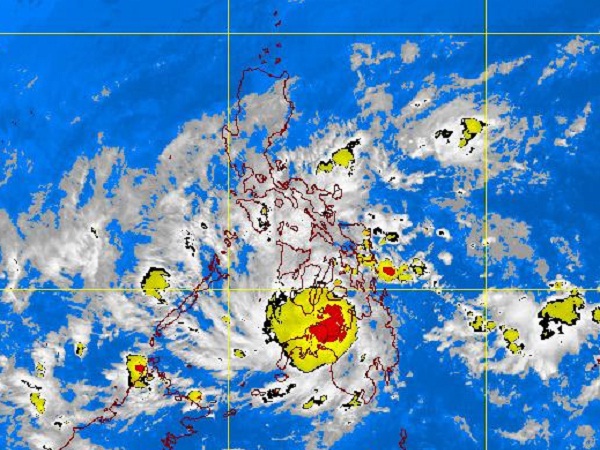
MTSAT ENHANCED IR Satellite Image for 3 a.m., 17 December 2011
MANILA, Philippines—Packing maximum sustained winds of 75 kph near the center and gustiness up to 90 kph, Tropical Storm “Sendong” (international name “Washi”) made landfall on Friday over Davao Oriental, triggering floods across parts of central and Northern Mindanao.
Classes were suspended in Ozamiz City as Sendong spawned knee- and waist-deep floods in about 60 percent of the city, according to Mayor Nova Princess Echavez.
It also took its toll on the start of the traditional nine-day Simbang Gabi which marks the Christmas Season in the Philippines, she added.
The holiday storm had accelerated slightly before hitting land, moving at 26 kph, weathermen said. It is expected to be 190 km West of Puerto Princesa City this morning, finally exiting the Philippine Area of Responsibility in the evening.
Storm Signal No. 2 was hoisted early Friday morning over Surigao del Norte, including Siargao Island, Surigao del Sur, Dinagat Province, Agusan provinces, Davao del Norte, Davao Oriental, Samal Island, Lanao provinces, Misamis provinces, Zamboanga provinces, North Cotabato, Compostela Valley, Bukidnon, Camiguin and Maguindanao in Mindanao. In the Visayas, the same public storm warning was raised over Southern Leyte, Bohol, southern Cebu, southern Negros and Siquijor Island.
Article continues after this advertisementSignal No. 1 was raised over Davao del Sur, Sultan Kudarat, South Cotabato, Sarangani province, Basilan province, Eastern Samar, Western Samar, Northern Leyte, northern Cebu, northern Negros, Iloilo, Capiz, Antique, Aklan and Guimaras province.
Article continues after this advertisementResidents in low-lying and mountainous areas under public storm warning signals were alerted against possible flash floods and landslides. Likewise, those living in coastal areas were warned of big waves or storm surges.
Philippine Atmospheric, Geophysical and Astronomical Services Administration (Pagasa) forecast heavy rains, estimated at 10 to 25 millimeter per hour within the 400-kilometer diameter of the storm.
Mining operators and small scale miners in Mindanao were alerted against possible flash floods and landslides.
The Philippine Coast Guard (PCG) on Friday warned ships not to sail in the areas affected by the storm.
In Davao City, volunteers in various villages had been mobilized in anticipation of flood-related problems, according to Pepito Capili, administrative officer of the Davao City Disaster Risk Reduction Management Council.
Capili said they were tightly monitoring the major river systems in the city.
In June, at least 30 people had been killed and 150,000 others were displaced when rivers in Davao City overflowed.
Gerry Pedrico, chief of Pagasa in southern Mindanao had said Davao City was not likely to be directly hit by the storm. But he warned that heavy rains and possibly flooding could occur in the city and nearby areas.
As of 2 p.m. Friday, some 7,750 passengers were stranded in ports where public storm warning signals were hoisted, according to Coast Guard Commandant Admiral Ramon Liwag.
Ports under the Coast Guard’s central and East Visayas District had the most number of stranded passengers: Cebu, 2,438; Dumaguete, 650; Maasin, 468; and Tagbilaran, 251. In the Bicol Region, the PCG district there reported 2,195 passengers stranded at Sorsogon port and 481 in Albay. There were about 1,100 passengers also stranded in various ports in Northern Mindanao, and a few more in ports in the Calabarzon and western Visayas districts.
Meanwhile, strong to gale force winds from the northeast are expected to affect northern Luzon and the western seaboard. Coastal waters along these areas will be moderate to rough, weathermen said. The eastern sections of northern and Central Luzon and the rest of southern Luzon will be mostly cloudy with scattered rainshowers and thunderstorms. With a report from Jerome Aning