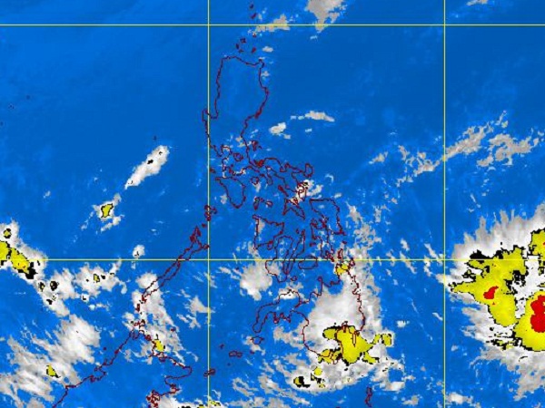
MTSAT ENHANCED IR Satellite Image for 9 a.m., 15 December 2011
MANILA, Philippines — A tropical depression was seen east of Mindanao, the Philippine Atmospheric, Geophysical and Astronomical Services Administration (Pagasa) said Thursday.
In its 2 a.m. forecast, Pagasa said that the tropical depression was seen 1,100 kilometerrs East of Mindanao packing maximum sustained winds of 55 kilometers per hour near the center.
It is expected to move west northwestward at 30 kph, Pagasa said.
Meanwhile, Southern Luzon, Visayas and Mindanao will experience mostly cloudy skies with scattered rains and thunderstorms with skies becoming cloudy over Northern and Eastern Mindanao, Pagasa said.
The rest of Luzon will have partly cloudy to cloudy skies with isolated rainshowers or thunderstorms, the state-run weather bureau said.
“Moderate to strong winds blowing from the Northeast will prevail over Northern Luzon and its coastal waters will be moderate to rough. Elsewhere, winds will be light to moderate coming from the east to northeast with slight to moderate seas,” Pagasa said.