‘Bomb cyclone’ snow, wind making travel dangerous in US Midwest

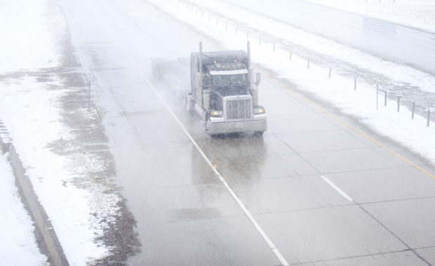
A truck travels east on Interstate 80 during a blizzard warning hitting southeast Wyoming and the Colorado Front Range on Wednesday, April 10, 2019, in Cheyenne. People in Colorado and Wyoming were urged to get home early Wednesday and stay there before snow and wind from a powerful spring storm make travel all but impossible.(Jacob Byk/The Wyoming Tribune Eagle via AP)
A storm system known as a “bomb cyclone” slowly churned through the U.S. interior Thursday for the second time in a month, unleashing a blizzard in parts of the Midwest while creating hazardous fire conditions farther south.
As much as 18 inches (46 centimeters) of snow has fallen in parts of South Dakota, where Gov. Kristi Noem has closed state offices in much of the state for a second day as heavy snow and strong winds make travel conditions dangerous.
Whiteout conditions were reported in northwest Kansas and western Nebraska, where the Department of Transportation closed several highways Thursday morning.
Schools in Minneapolis and St. Paul were among hundreds that closed in Minnesota, where as much as 2 feet (0.61 meters) of snow is expected by Friday.
The Minnesota State Patrol said it has responded to more 200 crashes statewide since Wednesday.
Article continues after this advertisementThe storm knocked out power Wednesday to thousands of homes and businesses in South Dakota, disrupted air and ground travel from Colorado to Minnesota, and threatened to swell rivers in the Midwest that flooded after March’s drenching.
Article continues after this advertisementBoth storms are known as a “bomb cyclone,” a weather phenomenon that entails a rapid drop in air pressure and a storm strengthening explosively, according to David Roth, a forecaster at the National Weather Service’s Weather Prediction Center in Maryland.
The latest storm’s impacts are likely to be similar to last month’s storm, Roth said.
That blast dropped heavy snow and led to massive flooding in the Midwest that caused billions of dollars in damage in Nebraska, Missouri, Iowa and South Dakota.
“Hopefully this time it will be a slow snowmelt,” Roth said.
Particularly hard hit by the storm were eastern South Dakota and southwestern Minnesota.
Winds in excess of 50 mph (80.46 kph) also were expected, creating life-threatening conditions, according to the National Weather Service.
“We’re calling it historic because of the widespread heavy snow. We will set some records,” said Mike Connelly, a weather service meteorologist in Aberdeen, South Dakota.
Transportation officials closed Interstate 29 from east central South Dakota to the North Dakota border, as well as a 270-mile (434-kilometer) section of Interstate 90 between Rapid City and Mitchell, South Dakota.
Numerous traffic crashes were reported in northeastern South Dakota, and the storm knocked out power to thousands of homes and businesses in Sioux Falls.
In Colorado, officials closed a 150-mile (241-kilometer) stretch of Interstate 76 from just northeast of Denver to the Nebraska border, and Gov. Jared Polis activated the National Guard in case troops are needed to rescue stranded motorists. Denver Public Schools announced delayed starts Thursday for some campuses due to weather.
About half of the daily flights at Denver International Airport were canceled on Wednesday.
In Nebraska, the State Patrol was sending additional troopers into the state’s panhandle, and officials closed Interstate 80 in that region.
“This storm is going to be dangerous,” Patrol Maj. Russ Stanczyk said.
An unusual but not rare weather phenomenon known as “thunder snow” — snow accompanied by thunder and lightning — was reported in central South Dakota.
“It’s essentially a thunderstorm, but it’s cold enough for snow,” Connelly said.
Nebraska Gov. Pete Ricketts extended five weather-related executive orders until May 15 to help communities gain fast access to the state’s emergency resources.
Minnesota Gov. Tim Walz said “the National Guard stands ready” to rescue any stranded motorists.
The weather service posted an ice storm warning into Friday morning for a portion of southern Minnesota, warning that thick ice could accumulate on power lines and lead to outages.
Strong winds associated with the weather system were also creating dangerous wildfire and travel conditions in New Mexico, Texas and Oklahoma.
The weather service issued a high wind warning for the Texas and Oklahoma panhandles.
Winds in excess of 50 mph (80.46 kph) were combining with low humidity and an unstable atmosphere to create critical fire conditions in the three states.
Forecasters in New Mexico said the winds also would make travel difficult on north-south oriented roads, such as Interstate 25.
In southern New Mexico, the U.S. Army’s White Sands Missile Range closed Wednesday because of the high winds.
Forecasters said this week’s storm will swell rivers again, though likely not to the levels seen last month due to the absence of a wet snowpack on frozen ground this time around. /gsg