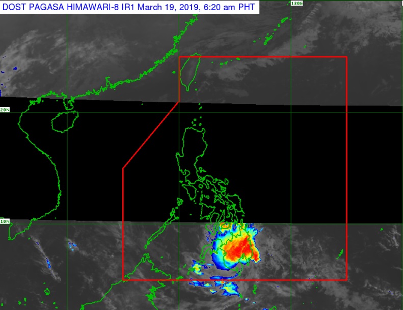
Tropical Depression ‘Chedeng’ can be seen over much of Mindanao in this satellite photo released by Pagasa on Tuesday morning, March 19, 2019. PAGASA PHOTO
MANILA, Philippines — Tropical Depression “Chedeng” slowed down early Tuesday ahead of its expected landfall over Davao Occidental.
It was last spotted 105 kilometers east of General Santos City, moving west southwest at 15 kph, the Philippine Atmospheric, Geophysical and Astronomical Services Administration (Pagasa) said in its 5 a.m. bulletin.
Pagasa, in its 2 a.m. report, reported Chedeng’s speed at 25 kph.
It was packing maximum sustained winds of 45 kilometers per hour near the center and gusts of up to 60 kph.
Chedeng is expected to make landfall over the eastern coast of Davao Occidental and weaken afterwards.
Storm Signal No. 1 was raised over Davao Oriental, Compostela Valley, Davao del Sur, Davao City, General Santos City, Davao Occidental, southern portion of Davao del Norte including Samal Island, eastern portion of North Cotabato, eastern portion of South Cotabato, eastern portion of Sarangani, and eastern portion of Sultan Kudarat.
Scattered to at times widespread moderate to heavy rain is likely over Surigao del Sur, Agusan del Sur, Davao Region, Soccsksargen, and portions of Northern Mindanao, Bangsamoro and Zamboanga Peninsula. /cbb