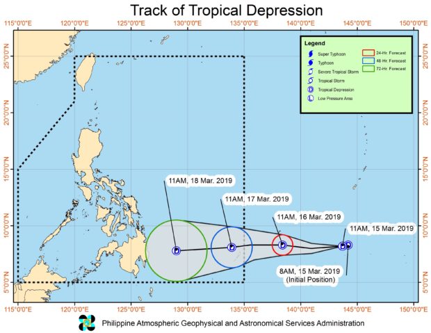

The weather disturbance was last spotted 1,910 kilometers east of Mindanao, the Philippine Atmospheric, Geophysical and Astronomical Services Administration (Pagasa) said.
It packed maximum sustained winds of 45 kilometers per hour (kph) and gustiness of up to 60 kph. It was moving westward at 20 kph.
Pagasa said if the tropical depression enters PAR on Saturday evening or Sunday morning, it will be locally named “Chedeng.”
Scattered to at times widespread heavy rains may be experienced over provinces in the eastern section of Mindanao on Monday and Tuesday due to the weather disturbance, according to Pagasa.
While unlikely, Pagasa also said it is still looking into a possibility of landfall over the eastern part of Mindanao either on Monday or Tuesday.
Pagasa advised residents in areas prone to landslides and flooding to continue monitoring for weather updates. /kga