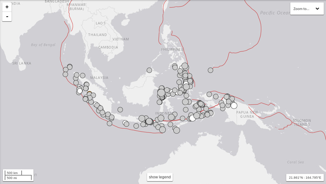
Data from the United States Geological Survey (USGS) shows that from Jan. 1 to Dec. 24, 2018, Indonesia experienced 221 earthquakes measuring more than magnitude 5. USGS via The Jakarta Post/Asia News Network
JAKARTA — The Meteorology, Climatology and Geophysics Agency (BMKG) has reported that a 6.0-magnitude earthquake hit West Sumba at 6:59 a.m. on Tuesday morning.
The earthquake’s epicenter is located at sea, 92 kilometers southwest of Waikabubak in West Sumba regency, East Nusa Tenggara, at a depth of 47 km.
The earthquake was felt strongly in Tambolaka, Waingapu, Sumbawa and Bima.
“The earthquake was caused by a thrust fault […]. There is no potential for a tsunami, ” the BMKG’s Earthquake and Tsunami Center head, Rahmat Triyono, said in a press statement on Tuesday.
“As of yet, we haven’t received any reports of damages caused by the earthquake,” Rahmat added.
As of 7:26 a.m., the BMKG recorded two aftershocks of 5.2 magnitude and 3.2 magnitude.