DOST ‘high-tech’ map key in disaster fight
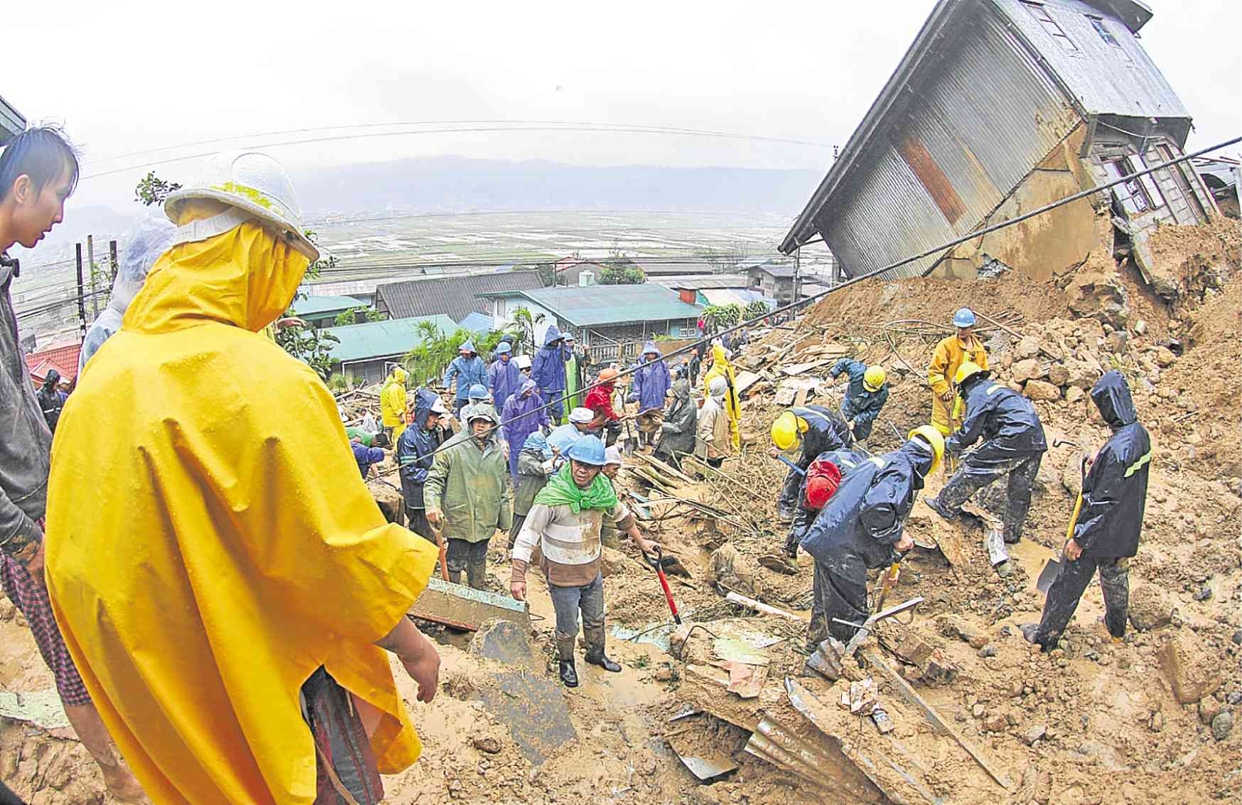
MOUNTAIN SLIDE In this 2009 photo, rescuers use shovels and pickaxes to remove soil, rocks and other debris as they race against time to search for victims of a landslide in La Trinidad town, Benguet province. —EV ESPIRITU
BAGUIO CITY—Charting Cordillera terrain using a modern imaging and data gathering tool to generate precise hazard maps and models could be the key to preventing massive landslides like what happened this year in Natonin town, Mountain Province, and Itogon town, Benguet province.
Mountain communities that have been prone to landslides could tap Light Detection and Ranging (LiDAR) for more accurate data on potential ground movements, according to Nancy Bantog, director of the Department of Science and Technology (DOST) in Cordillera.
LiDAR uses crisscrossing light beams projected from an aircraft to provide more information that could not be acquired from conventional satellite or aerial imagery.
Flood-prone sites
The disaster and exposure assessment for mitigation program, led by the DOST in collaboration with a team from the University of the Philippines Diliman, has covered more than 60 percent of the country’s 298,170-square-kilometer land area using LiDAR to map flood-prone areas, said program head, Enrico Paringit of the UP department of geodetic engineering.
At present, only portions of Baguio have been mapped at the request of John Hay Management Corp. to locate and count pine trees within Camp John Hay, he said.
Paringit introduced LiDAR technology to local disaster management officials here, hoping to get local governments to use it.
Slide simulation
He said LiDAR-collected data could be used to simulate landslides and their trajectory, and pinpoint areas vulnerable to a disaster. The same data would speed up search and rescue operations.
Paringit said these data, had the technology came earlier, could have prevented 97 people from being killed in the Itogon landslides on Sept. 15 and 30 people from being buried by the Natonin erosion.
Database
“It has a high probability of pinpointing where the houses may have been buried, which can help hasten recovery where time matters,” he said.
Once Cordillera is mapped out, a landslide database can be put up to help communities in the region understand how and where they could live safely.
Cebu was the first province in the country to request for LiDAR to map its area. The data would not only be used for disaster mitigation but also for land-use planning and inventory, Paringit said. —KARLSTON LAPNITEN