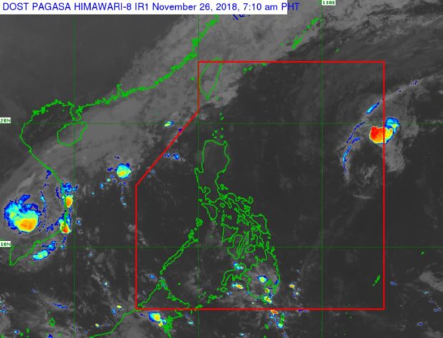
A smaller Severe Tropical Storm ‘Tomas’ can be seen on the upper right in this Pagasa satellite photo released Monday morning, Nov. 26, 2018. Pagasa said the cold and dry wind of the northeast monsoon was causing the storm’s clouds to break up. PAGASA IMAGE
A weaker Severe Tropical Storm “Tomas” (international name “Man-Yi”) re-entered the Philippine area of responsibility (PAR), the weather bureau said Monday.
The cold and dry air of the northeast monsoon (amihan) is causing the cloud formation of Tomas to break up and for it to lose strength, weather specialist Ariel Rojas said.
At 3 a.m. Monday, Tomas was spotted 1,410 kilometers east of Aparri, Cagayan, with maximum sustained winds of 110 kilometers per hour near the center and gusts of up to 135 kph.
It was moving northwest at 10 kph.
Rojas said the storm was expected to exit the PAR by Wednesday.
The northeast monsoon continues to affect Northern Luzon, the Philippine Atmospheric, Geophysical and Astronomical Services Administration said in its 5 a.m. bulletin.
The Ilocos Region, Cordillera Administrative Region, and Cagayan Valley Region will have isolated light rains.
Metro Manila and the rest of the country will have partly cloudy to cloudy skies with isolated rainshowers due to localized thunderstorms. /cbb