
The low-pressure area outside east of the Philippines has intensified into a tropical depression and may enter the Philippine area of responsibility over the weekend, the weather bureau said Thursday.
Weather specialist Ariel Rojas said the tropical cyclone was expected to enter the PAR on Saturday evening or Sunday morning.
The tropical depression, which will take the name “Samuel” when it enters PAR, was last spotted 2,715 kilometers east of Mindanao.
It was packing maximum sustained winds of 45 kilometers per hour (kph) near the center and gusts of up to 60 kph. It was moving westward at 20 kph.
The tropical cyclone will likely affect the eastern part of the Visayas or Mindanao.
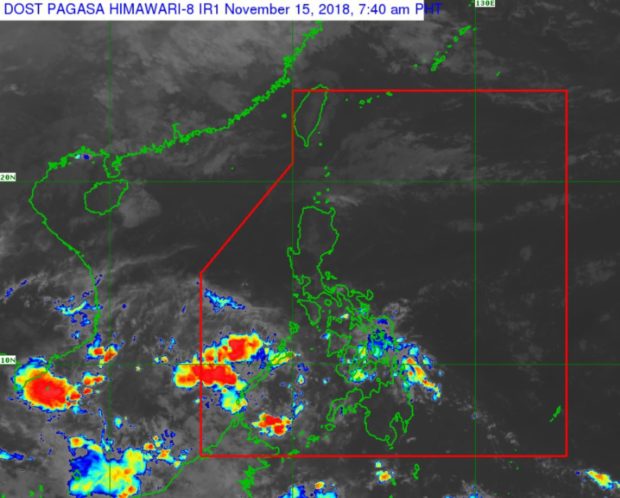
The LPA earlier monitored inside the PAR has dissipated but a new one has formed 370 kilometers southeast of Puerto Princesa City, Palawan. It is not expected to intensify into a storm, Rojas said.
The LPA will bring cloudy skies over Palawan, the Visayas, Northern Mindanao, Caraga, Zamboanga Peninsula, Basilan Sulu and Tawi-Tawi, the Philippine Atmospheric, Geophysical and Astronomical Services Administration said.
Batanes and the Babuyan Islands will also have cloudy skies with light rain due to the northeast monsoon.
Metro Manila, the Cordillera and Ilocos Regions and the rest of the country will have fair weather, Pagasa said. /cbb