
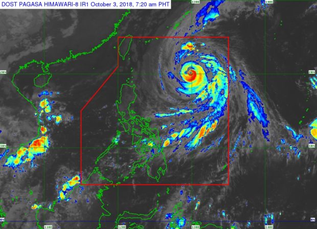
Typhoon ‘Queenie’ can be seen on the upper right of Luzon in this satellite image from PAGASA. PAGASA IMAGE
The trough of Typhoon “Queenie” will bring inclement weather over some parts of the country, the state weather bureau said on Wednesday.
The Philippine Atmospheric, Geophysical and Astronomical Services Administration (Pagasa) said cloudy skies with scattered rainshowers and thunderstorm weather condition would prevail over Central and Eastern Visayas, Northern Mindanao, and Caraga.
Pagasa told residents of these areas to take precautionary measures as severe thunderstorms might bring flashflood and landslides.
Meanwhile, Metro Manila and the rest of the country will have partly cloudy to cloudy skies with isolated rainshowers due to localized thunderstorms.
Queenie was spotted 875 kilometers east of Basco, Batanes, at 3 a.m.
It had maximum sustained winds of 200 kilometers per hour (kph) near the center and gustiness of up to 245 kph.
Queenie is moving northwest at 20 kph and is expected to leave the Philippine area of responsibility by Friday morning.
Pagasa said Queenie was not expected to make landfall over any part of the country but would affect sea conditions of the northern and eastern seaboards of Luzon. /cbb