‘Queenie’ turns into a supertyphoon as it moves through PAR
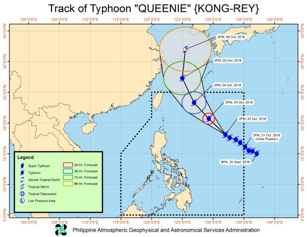
Image posted at the Pagasa website at 11:00 p.m. on Tuesday, Oct. 2, 2018.
“Queenie,” internationally known as “Kong-rey,” has intensified into a supertyphoon, according to a warning issued at 3:00 p.m. on Tuesday by the Joint Typhoon Warning Center, a US Department of Defense agency.
It is not, however, expected to make landfall in the Philippines, according to the Philippine Atmospheric, Geophysical and Astronomical Services (Pagasa).
As of 10:00 p.m., its eye was located at 1,000 km east of Calayan in Cagayan, moving northwest at 20 kph, according to the bulletin issued at 11:00 p.m. by Pagasa.
READ: Typhoon ‘Queenie’ slightly intensifies as it sweeps into PAR
It had maximum sustained winds of 200 kph near the center, with a gustiness reaching up to 245 kph.
As of this posting, Pagasa has not issued any storm warning signals.
The typhoon will bring light to at times moderate rains over the eastern section of the country.
The northern and eastern seaboards of Luzon will have rough to very rough seas, making sea travel in those areas risky.
The typhoon is expected to exit the Philippine area of responsibility (PAR) on Friday morning. /atm