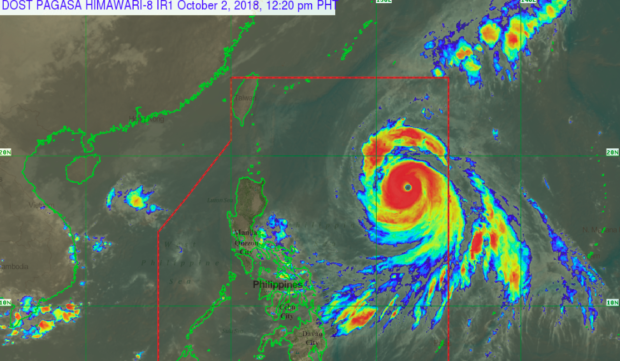
Typhoon “Queenie” inside PAR. SCREENGRAB FROM PAGASA-DOST
Typhoon “Queenie” on Tuesday continued to gather strength as it moves in its west-northwest track.
In its 11 a.m. weather update, Pagasa said Queenie packs a maximum sustained winds of 200 kilometers per hour (kph) with gustiness up to 245 kph.
The typhoon was last spotted at 1,130 kilometers east of Tuguegarao City, Cagayan at 10 a.m. Tuesday, moving in a west-northwest direction with a speed of 20 kph.
Pagasa said that even though the typhoon is not expected to make landfall in the country, its trough or extension is expected bring light to moderate rains in the eastern part of the country.
Strong to gale force winds are expected over Northern Luzon, and small sea vessels are advised not to venture out to the sea.
Queenie entered the Philippine Area of Responsibility on Monday afternoon and is expected to leave on Friday, Oct. 5, Pagasa said.
Pagasa said the typhoon may further intensify in the next 24-36 hours. /je