‘Queenie’ gains strength as it moves deeper into PAR
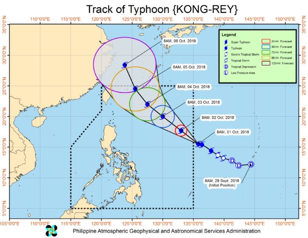
Typhoon “Queenie” (international name “Kong-Rey”) continued to intensify as it moved closer to the northern section of the country, the weather bureau said on Tuesday.
In its 4 a.m. weather bulletin, the Philippine Atmospheric, Geophysical and Astronomical Services Administration (Pagasa) said that as of 3 a.m., Queenie was spotted 1,250 kilometers East of Tuguegarao City, Cagayan.
Queenie had maximum sustained winds of 190 kilometers per hour (kph) near the center and gustiness up to 235 kph. It is moving northwest at a speed of 15 kph.
Pagasa’s Tropical Cyclone Advisory #3 issued at 11 a.m., Monday, Oct. 1, 2018, said the typhoon had maximum sustained winds of 145 kph and gusts of up to 180 kph.
The trough of the typhoon will bring cloudy skies with scattered rainshowers and thunderstorm over the Cagayan Valley Region, Bicol Region, Eastern Visayas and the provinces of Aurora and Quezon.
Pagasa advised the residents in those areas to prepare for possible flash floods or landslides due to severe thunderstorms.
Meanwhile, Metro Manila and the rest of the country will have partly cloudy to cloudy skies with isolated rainshowers due to localized thunderstorms. /cbb