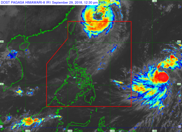
Source: Pagasa / DOST
Tropical depression named “Queenie” maintained its strength, which is expected to enter the Philippine Area of Responsibility (PAR) on Tuesday morning, October 2, the state weather bureau said on Saturday.
As of 10 a.m., “Queenie” was last spotted at 1,990 kilometers east of Visayas, moving west northwest at 45 kilometers per hour, the Philippine Atmospheric, Geophysical and Astronomical Services Administration (Pagasa) said in a tropical cyclone advisory No. 1.
It has a maximum sustained winds of 60 kph near its center and gustiness of up to 75 kilometers per hour.
Meanwhile, Typhoon “Paeng” (international name: Trami) has exited the PAR as of 6 a.m. on Saturday, the weather bureau said on Twitter. /jpv
As of 6:00 AM September 29, 2018, TY "Paeng" has exited the Philippine Area of Responsibility (PAR).
— PAGASA-DOST (@dost_pagasa) September 28, 2018


