
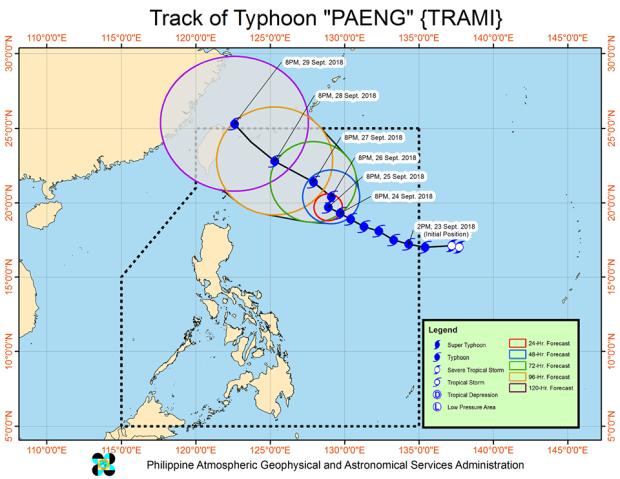
The track of Typhoon “Paeng,” as shown in a map posted at 11:33 p.m. on Facebook by Pagasa
Northern Luzon, which has barely recovered from the effects of Typhoon “Ompong” (internationally known as “Mangkhut”), may get light to moderate rains brought by Typhoon “Paeng” (internationally known as “Trami”) on Friday, Sept. 28, according to the Philippine Atmospheric, Geophysical and Astronomical Services Administration (Pagasa).
In its bulletin issued at 11:00 p.m. on Monday, Pagsasa said it would probably raise tropical cyclone warning signals over extreme Northern Luzon by Thursday or Friday.
Meanwhile, sea travel is risky over the northern and eastern seaboards of Luzon and the eastern seaboard of Visayas.
As of 10:00 p.m. on Monday, the new typhoon has slightly slowed, moving west-northwest at 15 kph, with maximum sustained winds of 185 kph near the center and a gustiness reaching up to 225 kph.
Pagasa located its eye at 795 km east of Basco, Batanes.
As of this posting, the forecast positions of the typhoon are as follows
- Tuesday evening: 730 km east of Basco, Batanes
- Wednesday evening:745 km east of Basco, Batanes
- Thursday evening): 625 km east of Basco, Batanes
- Friday evening: 435 km northeast of Basco, Batanes
- Saturday evening: 545 km north of Basco, Batanes (outside the Philippine area of responsibility).
/atm