Typhoon ‘Paeng’ enters PAR
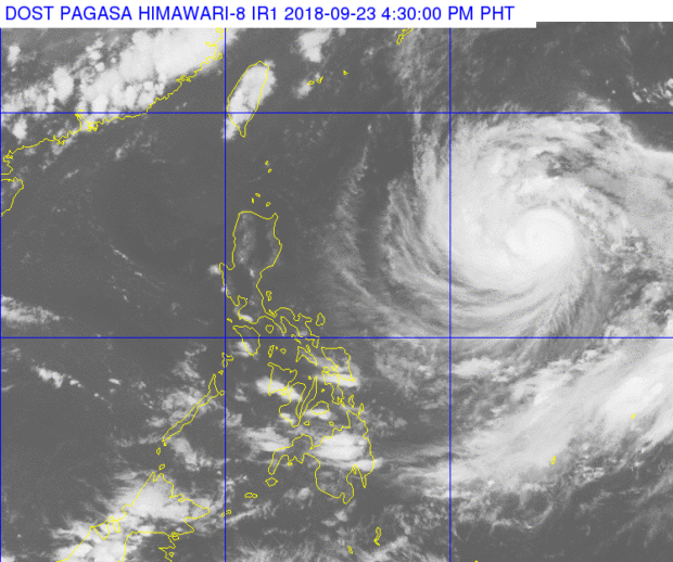
PHOTO FROM PAGASA DOST
Typhoon “Paeng” has entered the Philippine Area of Responsibility (PAR), the Philippine Atmospheric, Geophysical and Astronomical Services Administration (Pagasa) said.
In Pagasa’s severe weather bulletin, it said Paeng, with an international name of “Trami,” entered PAR on Sunday afternoon.
It noted that typhoon Paeng has no direct impact yet in any parts of the country but said that it might affect the extreme northern Luzon by Friday.
It added that a tropical cyclone warning may be raised over extreme northern Luzon by Thursday.
“No significant enhancement of the Southwest Monsoon is expected during the outlook period,” Pagasa said.
Article continues after this advertisementThe state weather bureau said that Paeng was last spotted 1,290 kilometers East of Tuguegarao City, Cagayan as of 4 p.m.
Article continues after this advertisementIt has a maximum of sustained winds of 125 kilometers per hour (kph) and gustiness up to 155 kph.
The weather disturbance is moving towards the west at a speed of 20 kph.
Pagasa forecasts that by Monday afternoon, Paeng would be at 960 kilometers east of Tuguegarao City, Cagayan.
“The public and the disaster risk reduction and management council concerned are advised to take appropriate actions and watch for the next update,” Pagasa said. /je
Related story: A stronger ‘Paeng’ heads towards Taiwan
Responding to appeals for help, the Inquirer is extending its relief efforts to the families affected by Typhoon Paeng. Cash donations may be deposited in the Inquirer Foundation Corp. Banco De Oro (BDO) Current Account No.: 007960018860 and through Maya