
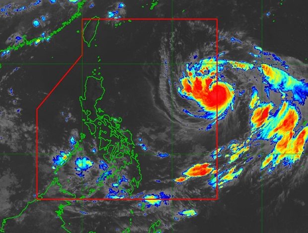
This satellite photo released by Pagasa shows the eye of Tropical Storm ‘Trami’ approaching the Philippine area of responsibility east of Luzon at 9:30 a.m. of Sunday, Sept. 23, 2018. PAGASA PHOTO
The weather bureau continues to monitor severe Tropical Storm “Trami” still outside the Philippine area of responsibility.
In its 4 a.m. weather forecast, the Philippine Atmospheric, Geophysical and Astronomical Services Administration (Pagasa) said Trami was last spotted 1,580 kilometers east of Central Luzon.
It had maximum sustained winds of 100 kilometers per hour (kph) and gustiness of 120 kph. It was moving west northeast at a speed of 20 kph.
Pagasa also said the Intertropical Convergence Zone (ITCZ) would still affect the southern Luzon, Visayas, and Mindanao.
The agency said the province of Palawan and islands in the Visayas and Mindanao would experience cloudy skies with scattered rainshowers and thunderstorm.
It advised residents in affected areas to watch out for possible flooding and landslides due to moderate to at times heavy rain.
Metro Manila and the rest of the country, meanwhile, will have partly cloudy to cloudy skies with isolated rain due to localized thunderstorms. /cbb