
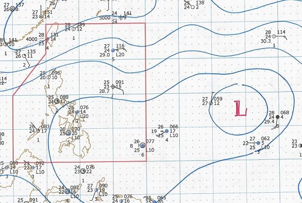
A weather analysis from Pagasa shows the low-pressure area east of the Philippines that may develop into a new storm. PAGASA IMAGE
The state weather bureau is tracking a low pressure area (LPA) that may form into a tropical cyclone in the coming days.
The LPA was spotted outside the Philippine area of responsibility (PAR), but may cross inside by Friday or Saturday, said weather forecaster Gener Quitlong in a Facebook video update on Wednesday.
The intertropical convergence zone remains the dominant weather system, affecting Southern Luzon and the Visayas, the Philippine Atmospheric, Geophysical and Astronomical Services Administration said.
Metro Manila, the Bicol Region, Calabarzon, Mimaropa, the Visayas and the province of Aurora will have cloudy skies with scattered rainshowers and thunderstorms.
The rest of the country will have isolated thunderstorms. /cbb