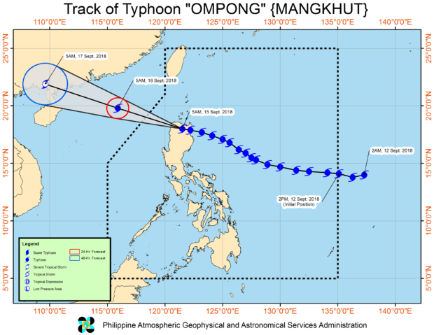
Source: DOST / Pagasa
Packing maximum sustained winds of 200 kilometers per hour and gustiness of 330 kph, typhoon “Ompong” (international name: Mangkhut) continues to rip through northern Luzon on Saturday, moving at a phase of 35 kph.
In an 8 a.m. weather bulletin, the Philippine Atmospheric, Geophysical and Astronomical Services Administration (Pagasa) raised Signal No. 4 in Ilocos Norte, Cagayan including Babuyan Group of Islands, northern Isabela, Apayao, Abra and Kalinga.
READ: ‘Ompong’ barrels through Abra
The eye of the typhoon was spotted in the vicinity of Baggao, Cagayan and it is moving west northwest toward Basco, Batanes.
With a slow phase in movement, Pagasa weather specialists explained that this means more rains will be dumped in areas affected by the typhoon.
Pagasa also warned the public of possible storm surge of up to six meters in the coastal areas of Cagayan and Ilocos Norte, advising residents to evacuate to higher grounds.
Pagasa said local residents in the affected areas may expect to experience winds of more than 171 kph up to 220 kph in the next 12 hours.
The weather bureau said Signal No. 3 remains in effect in Batanes, southern Isabela, Ilocos Sur, La Union, Mountain Province, Benguet, Ifugao, Nueva Vizcaya, Quirino and northern Aurora.
With the typhoon-enhanced habagat (southwest monsoon), several areas in Western Visayas, Zamboanga Peninsula, ARMM, and the rest of Mimaropa and Bicol region will also experience moderate to heavy rains.
Fisherfolks and those with small seacrafts are advised not to venture out over the seaboards of areas with cyclone warning signal. /jpv
RELATED VIDEO