SPECIAL REPORT: ‘Water world’ in Central Luzon
NO DRY LAND Residents in eight villages at the left bank of the dike in Masantol town, Pampanga province have never seen dry land since June 15. —PHOTOS BY MARCELO LACAP SR. / CONTRIBUTOR
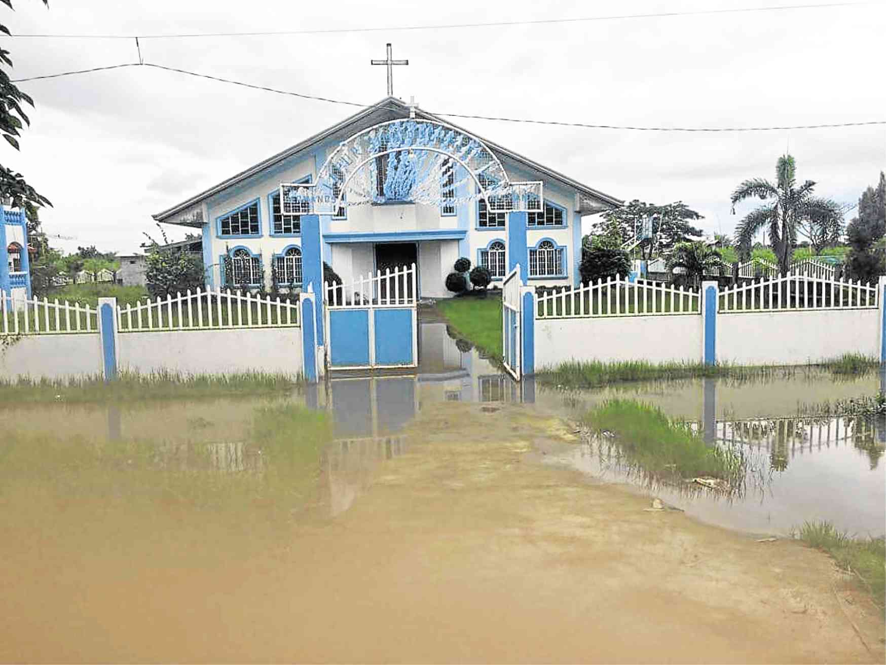
CITY OF SAN FERNANDO—Since late June, Marcelo Lacap Sr., a resident of Masantol town in Pampanga province, has not seen flooding ease in his village of Sagrada Familia.
“We have not seen a dry road yet,” said Lacap on the situation in his community.
Virtual water worlds are what have become of 245 villages located downstream of the Pampanga River in Central Luzon, after more than two months of rain.
Since June 15, rains induced by the southwest monsoon and the series of storms fell over Sagrada Familia. “Floodwaters are constantly in our home,” Lacap said.
The Lacaps, as well as their neighbors, have abandoned their homes facing Manila Bay and stayed with relatives whose houses are two- or three-story high or are built inland.
Article continues after this advertisementOther families pitched tents on top of a dike built in 2003 through Phase 1 of the Japan-funded Pampanga Delta Development Project (PDDP).
Article continues after this advertisementSagrada Familia, “Batun Dalig” to older residents, mirrors the plight of Pampanga and Bulacan communities that are at the mouth of the Pampanga River.
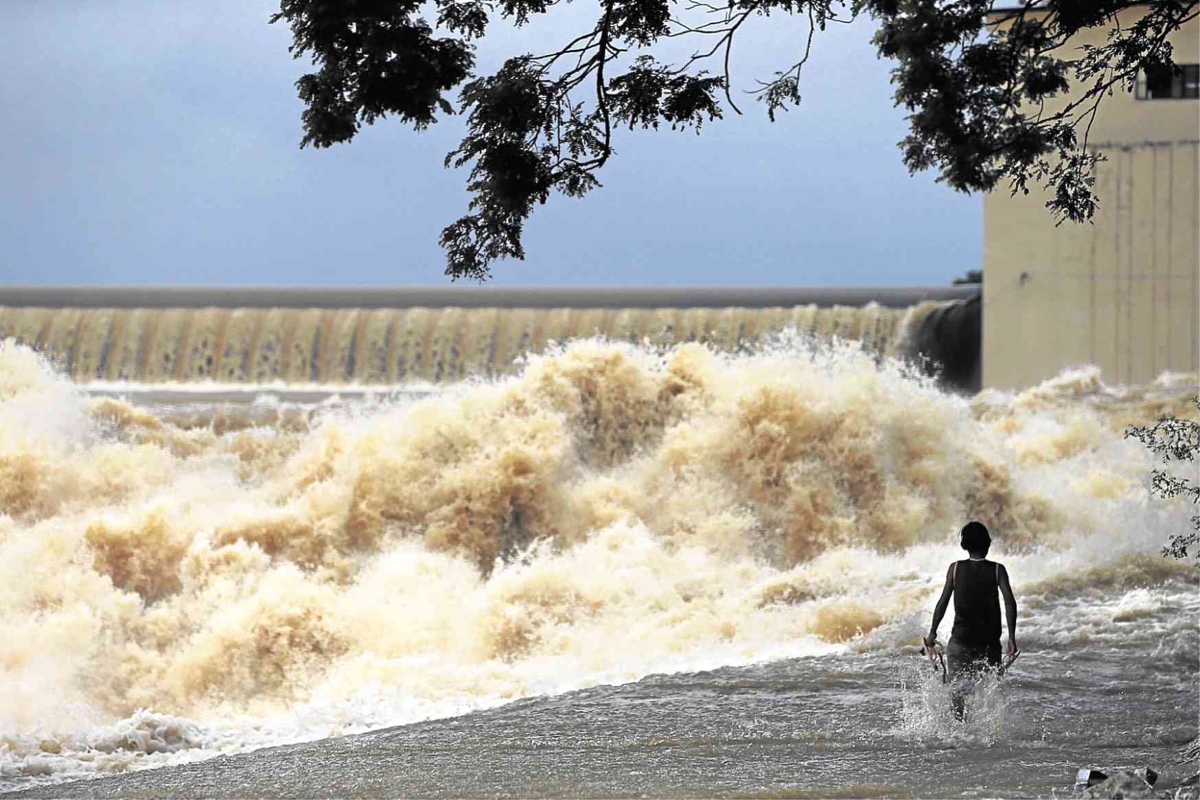
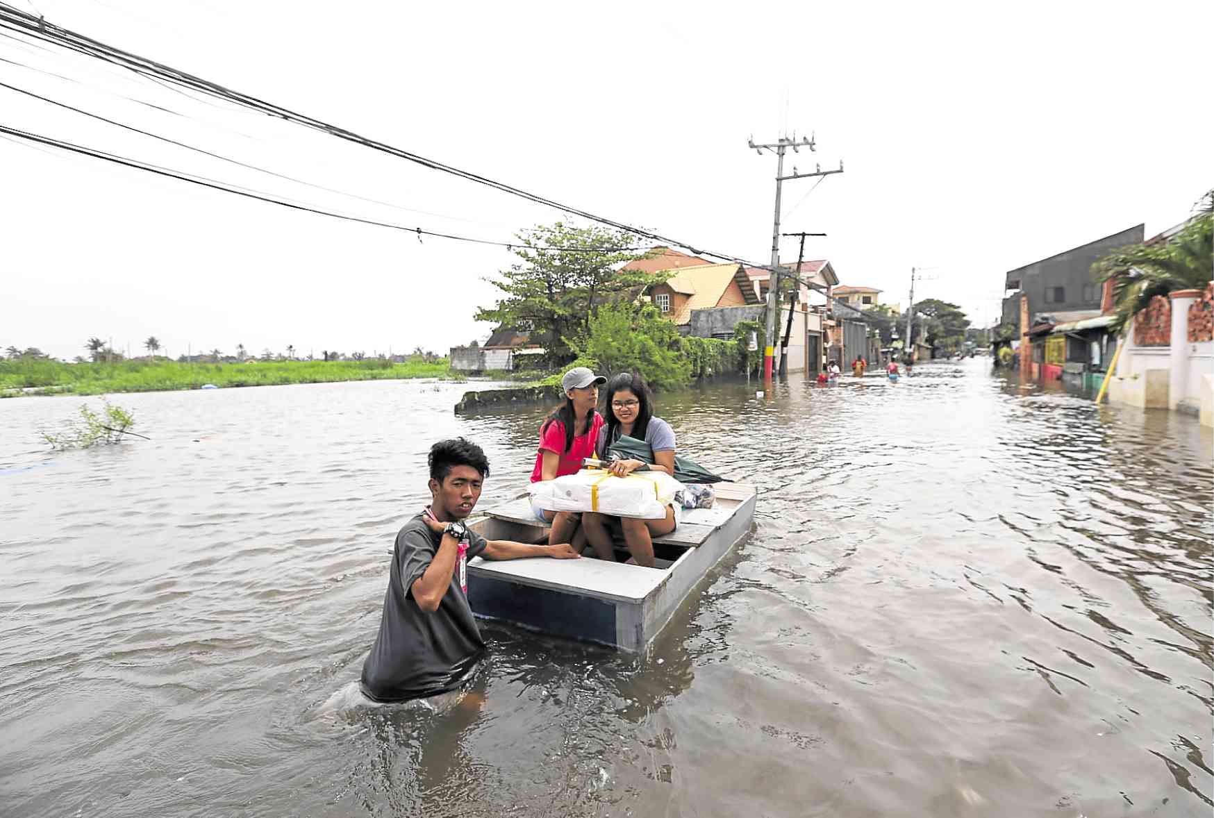
DAM SPILL The operator of Bustos Dam in Bulacan province releases water to reduce its reservoir level amid heavy rains. Below, residents in Balagtas, Bulacan, use a makeshift boat as floodwaters rise. —PHOTOS BY EDWIN BACASMAS AND LYN RILLON
Reports from the Regional Disaster Risk Reduction and Management Council (RDRRMC) from June 15 to Aug. 20 show that floods often recur in many villages dotting the 60-kilometer stretch of the Pampanga River, including portions of Nueva Ecija and Bataan provinces.
During this period, floodwaters rose from 0.3 meters (1 foot) to 1.83 m (6 ft).
The latest flooding occurred in what the weather bureau classified as Central Luzon’s wet season (characterized by monsoon and heavy rains) covering June, July and August.
But the current floods had exceeded the usual duration of two to 24 days during 25 big floods recorded from 1990 to 2010. The floods had killed 939 residents and displaced 4.1 million people in Central Luzon.
Floods persisted for over two months in the Pampanga towns of Macabebe, Masantol, San Luis, Guagua, Lubao and Sasmuan; the Bulacan towns of Calumpit and Paombong; and the towns of Licab and San Antonio in Nueva Ecija.
In Bataan, Barangay Pita and Luacan in Dinalupihan town and Barangay Almacen in Hermosa town were submerged for less than a month.
Cycle of flooding
These communities are suffering from an “uninterrupted cycle of flooding,” said Angelina Blanco, action officer of the Pampanga Disaster Risk Reduction and Management Office.
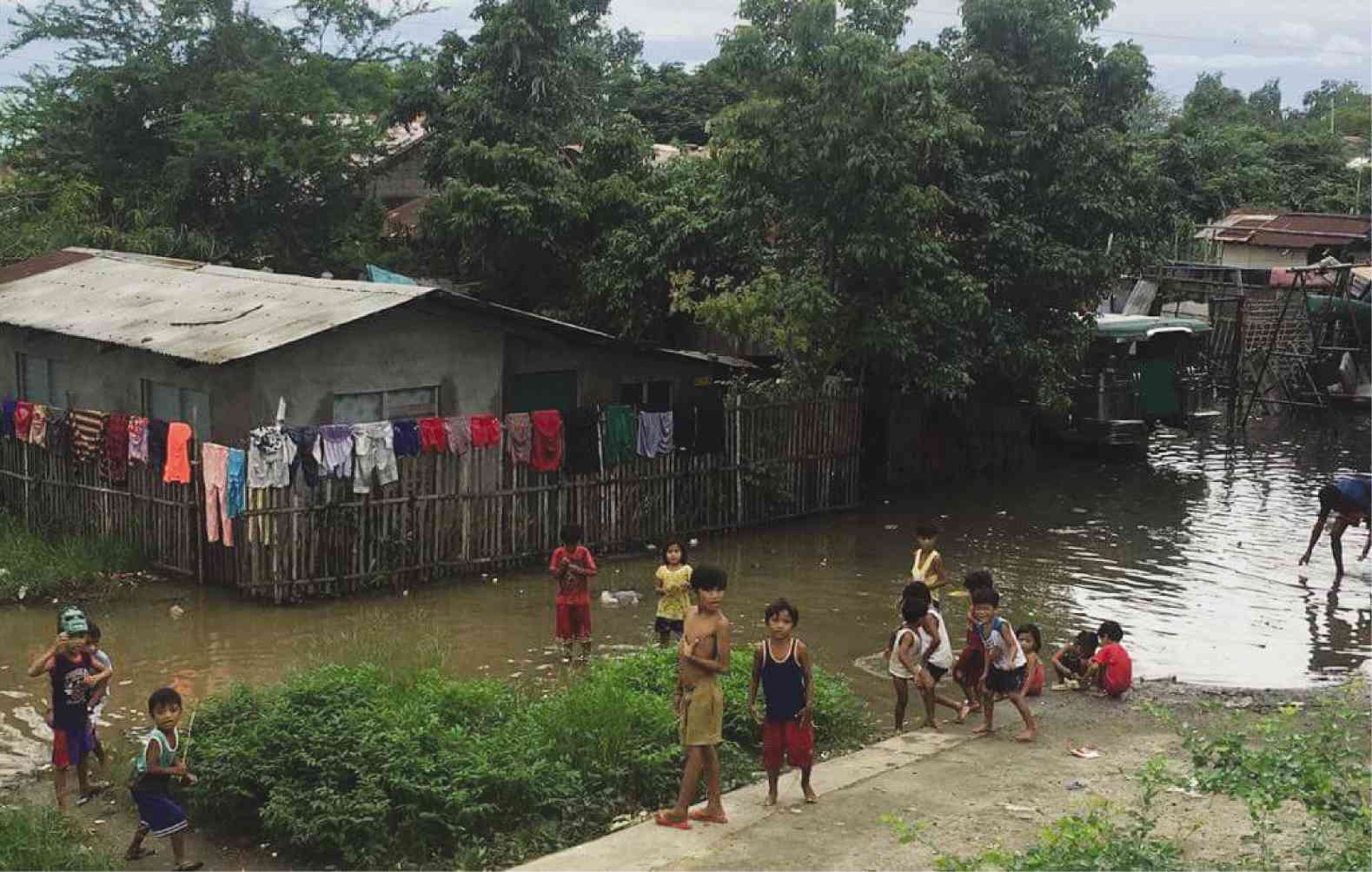
The number of people experiencing floods of longer duration has not yet been determined. But the Department of Social Welfare and Development placed the “affected” population in six Central Luzon provinces at 1.106 million as of Aug. 20.
By now, stagnant floodwaters have turned mossy and murky, and are also stinking up the neighborhoods. Several local governments have placed their towns and cities under a state of calamity because of severe or prolonged flooding.
Being located at the tail end of the 265-km Pampanga River is a problem in itself, according to Marlou Salazar, Central Luzon director of the Office of Civil Defense and RDRRMC chair.
“The lowest elevation, which is almost equal to mean sea level, extends widely at around the river mouth of Pampanga River basin,” the National Economic and Development Authority (Neda) said in the study “Climate Responsive Integrated Master Plan for Pampanga River Basin” released in January. (See map).
More than 55 percent of the basin area has slopes of less than 3 percent, the Neda said, citing another study by the Japan International Cooperation Agency (Jica) and the National Water Resources Board in 2011.
The most downstream area, where Masantol and Macabebe are located, is “lower than 5 m above mean sea level.”
Catchment area
So much water also spills down there. The Pampanga River originates from the Caraballo mountains in the Cordillera and merges with the large rivers of Pantabangan town in Nueva Ecija, Angat in Bulacan and Pasac in Pampanga before it finally drains out to Manila Bay.
Water can be absorbed in a big catchment area—at 10,434 square kilometers, or one-half the size of Central Luzon—but water seeks its own course and flows toward lower ground.
Where the Pampanga River and Manila Bay are supposed to meet has been obstructed by silt. Fishermen in Macabebe say that the silt accumulating at the mouth of the Pampanga River is higher by 0.61 m (2 ft) than the level of silt at Manila Bay, causing the water to “backflow” (flow in reverse).
They observe that tides enter the river only when strong winds push these inland.
Rains do a lot more damage by loosening silt from the Caraballo and Sierra Madre mountain ranges and by washing down mud and sand spewed out by Mt. Pinatubo’s 1991 eruptions. Garbage flushed down the rivers also contributes to flooding.
Pampanga Gov. Lilia Pineda has appealed to Public Works Secretary Mark Villar to assign a large dredging equipment to do year-round extraction of silt to spare riverbank communities from destructive floods.
But the Department of Public Works and Highways (DPWH) needs to be cautious about dredging “too deep” to prevent saltwater intrusion into the province’s water system, an official said at a recent forum.
Interventions
Pineda had complained that most of the DPWH’s interventions were concentrated upstream in the fourth district. These consisted of dikes and embankments that wore out immediately.
The last large-scale dike at the mouth of the Pampanga River in Masantol and Macabebe was put up in 2003 after the DPWH implemented the PDDP through a 30-year loan from Japan.
Residents who were displaced by the project had complained that the dike and the widening of the mouth of the river to 750 m had not been effective in protecting them from floods.
Sinking
Faced with politicians’ grumblings and residents’ protests, the DPWH had canceled a project that would have tapped the San Antonio and Candaba swamps in Nueva Ecija, Pampanga and Bulacan to retard the flow of water flowing downstream.
Floods may have been worsened by subsidence, which naturally occurs in areas at the mouths of rivers. Pampanga’s coastal areas are sinking at 0.5 to 2.5 centimeters per year, according to a 2002 Jica study.
Northern Manila Bay areas in Pampanga, Bulacan and Bataan as well as the cities of Caloocan, Malabon, Navotas and Valenzuela are sinking by 2 to 8 cm a year, geologists Kelvin Rodolfo and Fernando Siringan also said in a 2005 study.
They advised the reduction of groundwater pumping, especially by farms and fishponds, to prevent sinking. Flooding, they said, is also aggravated by sea level rise of 1 to 3 millimeters per year in the Manila Bay area.
How much of the current flooding is caused by water released from dams is not immediately known.
In 2011, Bulacan Gov. Wilhelmino Sy-Alvarado attributed the floods in Calumpit and Hagonoy to the discharge of water from Angat Dam that had taken more water from the Umiray transbasin in Aurora province.
The intake of Pantabangan Dam includes water from the Casecnan River in Nueva Vizcaya province and the Agno River in Pangasinan province.
For Rodolfo and Siringan, southwest monsoons and typhoons “cannot be blamed for the worsening floods.” Storms had dumped 2,000 mm of rain in the region but rainfall had been decreasing since 1990, they said, citing the reports of the Intergovernmental Panel on Climate Change in 1995 and a team in 1996.
“Due to an unfortunate combination of coastal configuration and seasonal wind regime, waves generated during the rainy southwest monsoon also raise tide levels by as much as 80 percent at the northern end of the bay, thus hindering runoff into the bay,” they said.