Too much rain, high tide keep Pangasinan under water for weeks
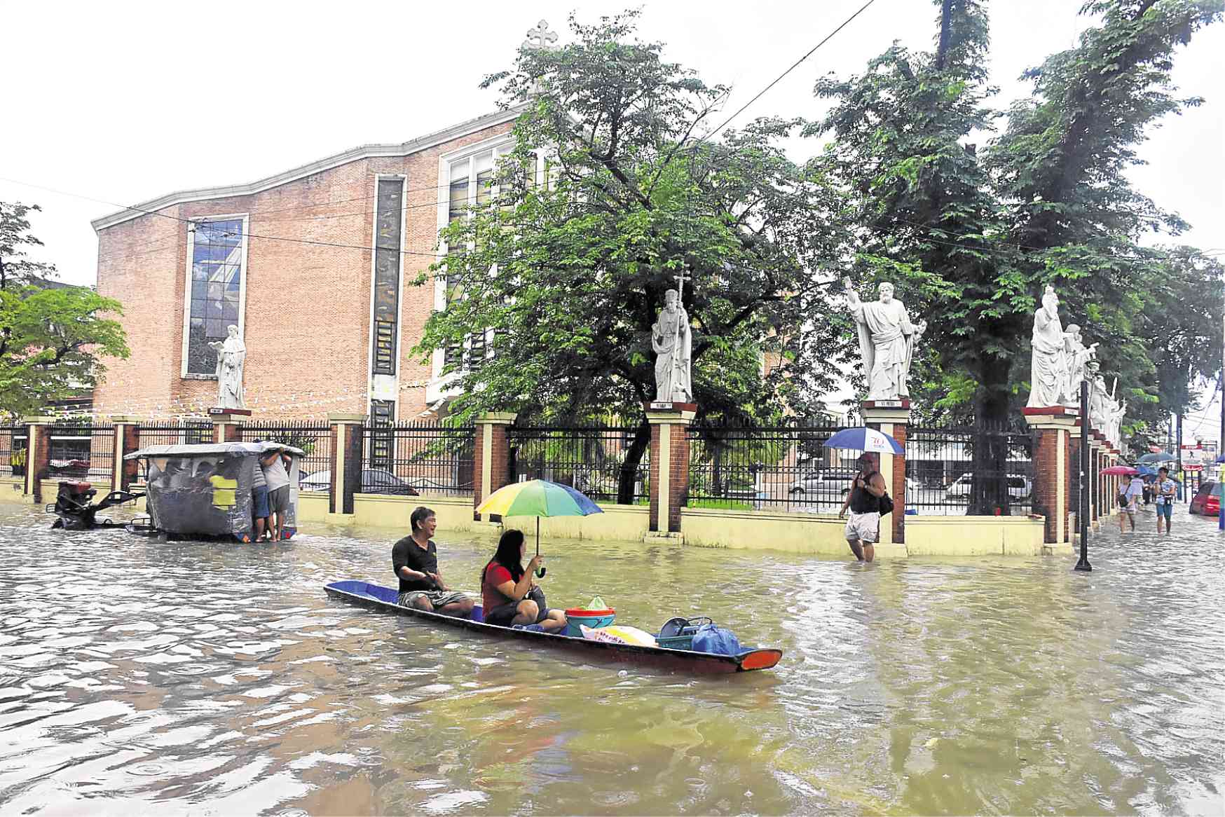
DAGUPAN DROWNING Heavy rains and high tide have submerged Dagupan’s business district, forcing residents to take boats and the farm vehicle “kuliglig” to move around the city. —WILLIE LOMIBAO
DAGUPAN CITY—News reports that San Roque Dam in San Manuel town was opening one of its six spillway gates on August 12 sent Menard Sadim, a freelance photographer, worrying.
Citing his experience, Sadim was sure that 30 hours after the dam spilled water, the subdivision where he lived since the 1980s at Barangay Tapuac here, would get flooded.
“I just know that the water is from San Roque because [its color is] brown,” he said.
How the water from San Roque Dam finds its way to this city continues to be the subject of heated discussions among residents and social media every time a massive flood hits this city.
Dam discharge
Article continues after this advertisementEven city officials believe that the dam discharge is the source of major flooding in the city. They blame overflowing irrigation canals from the dam’s reregulating pond.
Article continues after this advertisementBut Greg de Vera, head of the Agno River Basin Flood Forecasting and Warning Center (ARBFFWC), said spilled water from San Roque Dam could not have contributed to the widespread flooding that struck Dagupan and the neighboring towns of Calasiao and Sta. Barbara last month.
ARBFFWC is an agency attached to the Philippine Atmospheric, Geophysical and Astronomical Services Administration (Pagasa).
According to De Vera, water released by the dam flows straight to the Agno River, which cuts through 17 towns and San Carlos City before it exits to the Lingayen Gulf in Lingayen town.
The water that had flooded Dagupan last month and early this month, he said, came from the Sinocalan River, which is not connected to the Agno River.
Sinocalan, which has its headwaters on Mt. Ampucao in Benguet province, cuts through the towns of San Manuel, Binalonan, Laoac, Mapandan, Sta. Barbara and Calasiao, and Dagupan City.
When floods submerged Dagupan, Calasiao and Sta. Barbara last month, there was too much rainfall due to the southwest monsoon enhanced by Tropical Depressions “Inday” and “Josie,” according to Jose Estrada Jr., local Pagasa chief meteorologist.
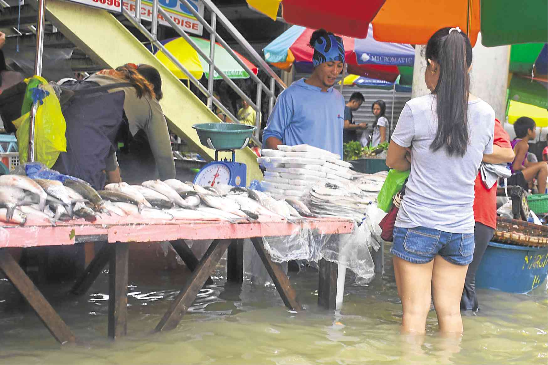
MARKET DAY A woman ignores floodwaters as she buys “bangus” (milkfish) at a market stall in Dagupan. —WILLIE LOMIBAO
Pagasa recorded 1,169 millimeters of rainfall in July, about 550 percent more than the city’s normal rainfall of 212 mm. (In a 1-mm rainfall, an area of 1 square meter gets a liter of rainwater.) In addition, 719 mm of rainfall on Mt. Ampucao fell from July 16 to 23, as indicated by the ARBFFWC rainfall monitor.
“There was really a lot of water,” Estrada said.
The rampaging floodwaters breached the earth dikes in Sta. Barbara and topped those in Calasiao, hastening the flow of water toward Dagupan.
It was the first time since 2009 that so much water was dumped by monsoon rains in the city. In 2009, Typhoon “Pepeng” dumped rains that filled up San Roque Dam and the province’s river systems, causing widespread flooding.
Residents here said it was taking too long for floodwaters to recede unlike in the past years. In July, it took 11 days before water receded and allowed business establishments to reopen and classes to resume.
Water nowhere to go
In social media, fingerpointing has begun. Netizens said that had it not been for the recent backfilling of fishponds in Dagupan, the natural flow of water to the sea would have been unhampered.
A former city official said floods had taken place in many parts of the city because water had nowhere to go.
But Estrada said the rising sea level was one of the factors that had slowed down the exit of floodwaters to the sea.
High tide raises floodwaters by 1.5 meters, enough to submerge low-lying areas. The city has an average elevation of 1 meter above sea level.
Another factor is that the city rivers are silted and could not absorb much water, Estrada said. This city is crisscrossed by seven rivers and 14 creeks.
A 2014 study, Business Risk Assessment and the Management of Climate Change Impacts conducted by the Bank of the Philippine Islands Foundation and the World Wide Fund for Nature, said that seven of 31 villages occupying up to 40 percent of the city’s 43-square-kilometer land area, get flooded—even on sunny days—whenever high tide occurs.