
Vientiane Times/Asia News Network Photo
KHAMMUAN, Laos — This year has not been a good one for Laos when it comes to flooding as many areas have been inundated since late last month due to heavy rain.
In northern Laos, many houses along rivers as well as some bridges collapsed into the raging waters. In addition, road closures and landslides have become commonplace, caused by the downpours.
In the country’s south, Attapeu province was greatly affected when a dam wall at the Xe-Pian Xe-Namnoy hydropower plant in Sanamxay district collapsed last week, triggered at least in part by torrential rain.
So far, lowlands in Borikhamxay, Khammuan, Savannakhet and Champassak alongside the Mekong and Road 13 South have been swamped.
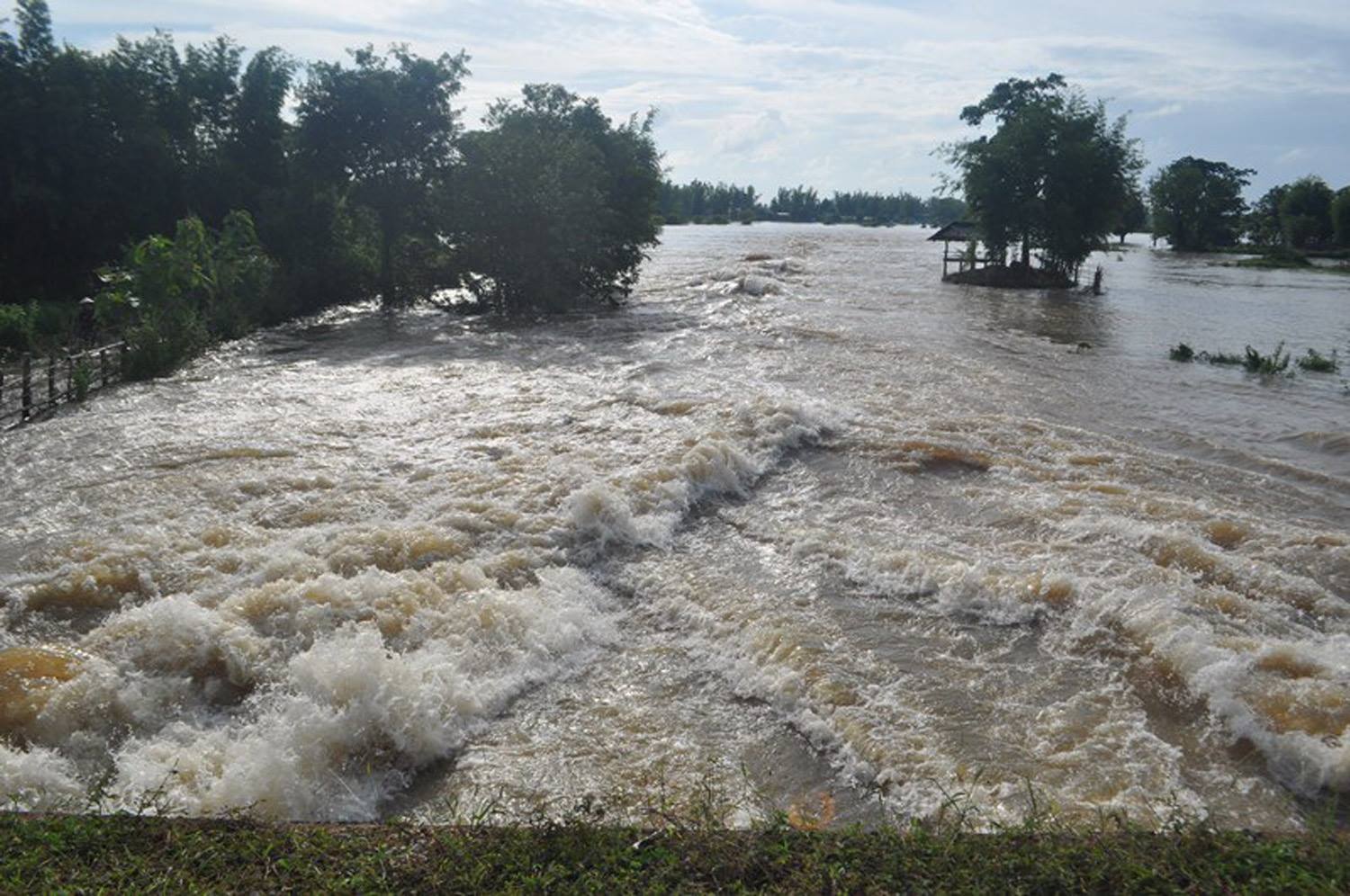
The rivers have been swollen in many areas throughout Khammuan province since the end of last month, although thankfully no deaths have been reported in the province so far.
Because of the tremendous increase of water, the Mekong and its tributaries have breached their banks, affecting many riverine communities.
Khammuan province’s 10 districts of Thakhaek, Mahaxay, Nongbok, Hinboun, Yommalath, Bualapha, Nakai, Xabangfay, Xaybuathong and Khounkham have all been affected by heavy rain.
A report from the province on Tuesday pointed out that 325 villages were flooded. Some have had the misfortune to be inundated twice.
An official from Khammuan province Mr Khamphay Phengpengmeuang, told Vientiane Times on Thursday the province had provided some shelters in flood-affected areas.
“Affected residents can stay at the shelters or with their relatives in houses that are clear of the floods,” he said.
Residents in the districts of Xebangfay, Nongbok, Hinboun, Yommalath and Mahaxay along the Xebangfay River and its branches have witnessed rising water swamping houses and rice fields.
Residents near the Xebangfay Bridge, which links the provinces of Khammuan and Savannakhet, were still anxiously watching the water level which was not far below the usually elevated bridge.
On Tuesday, the province reported the river level peaking at the bridge at 21.82 meters but the danger mark is 18.50 meters.
Even though the rain had moderated on Tuesday in Khammuan the huge volume of water in both the Xebangfay and Mekong rivers was contributing to very high water levels at their confluence near the bridge this week.
However, people living on both sides of the bridge are not flooded because these areas are elevated.
But in the lowlands, many rice fields are now submerged after these rivers began overflowing after the heavy rains since last week in Khammuan and other central and southern parts of the country.
Mr Khamphay said the Mekong continues to rise in the province fed by its swollen tributaries. In addition, some branches are backing up and unable to release their torrent from the heavens into the Mekong.
If the river rises to a level of 18.50 meters and above, then several hundred hectares of rice fields will be flooded.
The flooding also means that most of the rice crop is likely to fail after being inundated. Now, about 28,630 hectares of rice is underwater in the province.
If the river rises to almost 20 meters then hundreds of homes in Xebangfay district will also be swamped.
The province now needs donations of rice and drinking water from the general public for people in areas affected by flooding.
Each year, thousands of residents across the country are affected by floods and other natural disasters. As a nation, we should do more to improve disaster preparedness, aiming to reduce the impact of extreme weather events on local communities.
Natural disasters are external shocks that can have major impacts on the social and economic welfare of a population and provide a serious obstacle to the achievement of sustainable socio-economic development.