
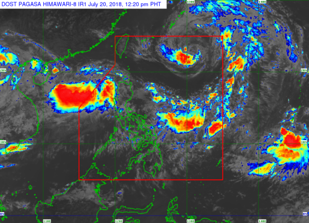
July 20, 2018 / 12:20 p.m. weather satellite image from Pagasa website
“Inday” intensified into a severe tropical storm midday Friday as it continued to head northwest, away from the Philippine area of responsibility (PAR).
But a new low pressure area (LPA) outside of the PAR was spotted by the Philippine Atmospheric Geophysical and Astronomical Services Administration (Pagasa) 475 kilometers west of Laoag City.
Inday packed maximum sustained winds of 90 kilometers per hour (kph) near the center and gustiness of up to 115 kph, the state weather agency said.
Inday was last spotted 925 kilometers east northeast of Basco, Batanes as it maintained its pace of 15 kph northwest. It is expected to exit the PAR by Friday evening or Saturday morning.
The new LPA, Inday, and the prevailing southwest monsoon kept most parts of Luzon wet on Friday, as it brought intermittent moderate to heavy rains over Ilocos Region, Cordillera Administrative Region, Zambales, Bataan, Pampanga, Bulacan, Tarlac and Nueva Ecija, Pagasa said.
Meanwhile, Metro Manila and the rest of Luzon will continue to experience scattered light to moderate with occasional heavy rains until Saturday, July 21, Pagasa added.
The weather agency then reiterated that sea travel was still risky over the western seaboard of Central Luzon due to the southwest monsoon. /kga