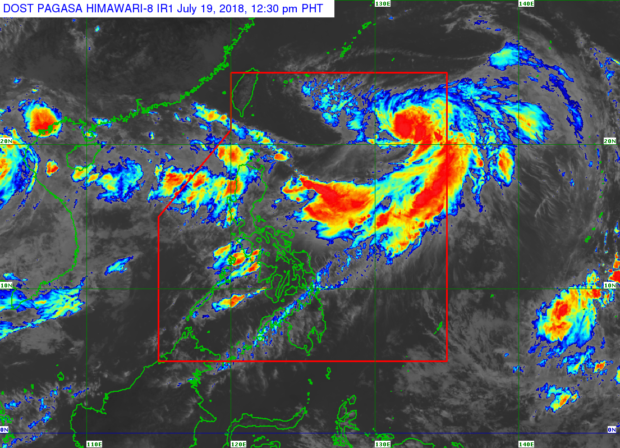
As of 12:30 p.m., July 19, 2018 / From Pagasa website
Tropical Storm “Inday” slightly intensified as it started to move towards the north and hopefully leave the Philippine Area of Responsibility (PAR) by Saturday, July 21.
Weather specialist Loriedin dela Cruz said Inday now packs maximum sustained winds of up to 75 kilometers per hour (kph) near the center and gustiness of up to 90 kph but will remain in the category of a tropical storm.
Inday was last spotted 935 kilometers east of Basco, Batanes and moving east-northeast at 20kph, according to the 11 a.m. bulletin of the Philippine Atmospheric Geophysical and Astronomical Services Administration (Pagasa).
The current weather disturbance has no direct effect on any Philippine land mass, thus, no tropical cyclone warning signals were declared over areas affected by Inday, Dela Cruz said.
Pagasa, nevertheless, said Inday continuously enhances the prevailing southwest monsoon, which continues to dump rains over the western section of Luzon, including Metro Manila.
Pagasa noted the Philippine Coast Guard disallowed small fishing vessels to set out at sea due to a gale warning raised in coastal areas of Bataan, Zambales, Isabela, and Aurora.
Based on the latest Pagasa weather bulletin, Dela Cruz said recurrent moderate to heavy rains would likely occur in the Ilocos Region, Cordillera Administrative Region, Bataan, and Zambales.
Metro Manila and the rest of Luzon will have isolated light to moderate to at times heavy rain.
Residents in areas affected by the monsoon rains are cautioned against possible floods and landslides.
Visayas and Mindanao will experience partly cloudy to cloudy skies with rainshowers or thunderstorms around Thursday afternoon or evening, Dela Cruz said. /kga


