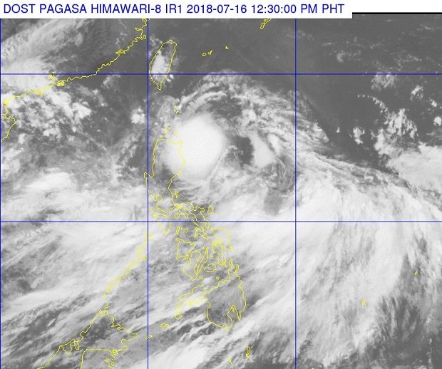
Clouds of Tropical Depression ‘Henry’ can be seen over the eastern part of Northern Luzon in this photo released by Pagasa on Monday, July 16, 2018. PAGASA PHOTO
Tropical Depression “Henry” may be out of the Philippine area of responsibility (PAR) on Tuesday morning as it moved slightly faster towards the western part of the country, the weather bureau said Monday.
The Philippine Atmospheric, Geophysical and Astronomical Services Administration (Pagasa) said in a press conference that Henry was moving faster at 35 kilometers per hour.
The weather bureau’s 24-hour forecast said that after crossing the northern part of Luzon tonight, it may be located 300 kilometers west of Calayan, Cagayan, by Tuesday.
Tropical Cyclone Warning Signal #1 is still raised over areas of Northern Cagayan, the Babuyan Group of Islands, the northern portion of Apayao, and the northernmost part of Ilocos Norte.
With maximum sustained winds of 55 kilometers per hour and gustiness of up to 65 kilometers per hour, Henry is relatively weaker compared to other weather disturbances. However, Pagasa still warned of possible flooding and landslides in different areas due to an enhanced southwest monsoon.
Parts of Metro Manila, Zambales, Bataan, Cavite, Batangas, Mindoro Provinces, Palawan and Western Visayas will be affected by monsoon rain while the rest of Luzon will experience occasional rain showers and thunderstorms.
Pagasa again urged fishermen with small sea craft to avoid sailing out to the seaboards of areas under the storm signal, and along the western seaboard of Luzon. /cbb