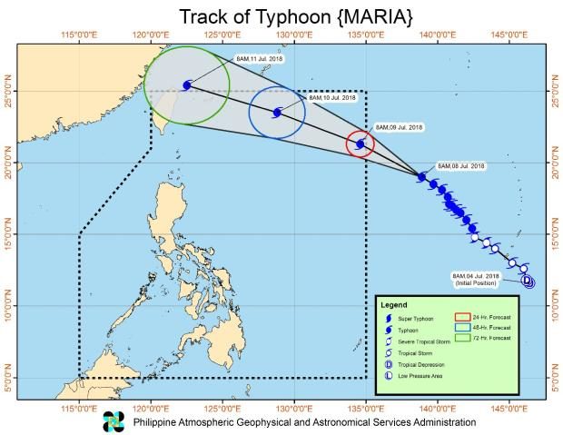
‘Maria’ unlikely to make landfall

Philippine Atmospheric, Geophysical and Astronomical Services Administration (Pagasa) forecasters said that Maria might pass through the Philippine area of responsibility (PAR) on Monday morning, skirting the country’s landmass, as it heads toward Taiwan and China.
Supertyphoon
The typhoon with the international name Maria, to be named “Gardo” when it enters the PAR, has been categorized by the Hawaii-based Joint Typhoon Warning Center as a
supertyphoon.
In Pagasa’s advisory on Sunday, it said that Maria might enhance the monsoon triggering rains until Tuesday over Mimaropa (Mindoro, Marinduque, Romblon and Palawan) and Panay Island while bringing occasional rains over Metro Manila, the western sections of Southern and Central Luzon, and the rest of Western Visayas.
As of 3 p.m. on Sunday, the eye of Typhoon Maria was estimated at 1,625 kilometers east of northern Luzon.
Article continues after this advertisementMaria has sustained winds of 190 kilometers per hour and gusts of up to 235 kph and is moving northwest at a speed of 23 kph.